Sunday, June 30, 2013

Melting Zone

Ok, so everyone seems to be talking about the heat…who has it the worst, who has been able to find a way out of it, who can find some unique, or not so unique, way to cope with it.  Sacramento’s all time “high”, according to various sites, is 115 degrees.  Tomorrow the forecast was for 111 degrees, now changed to 109 degrees with the 111 degrees now forecast for Tuesday…of course, this call can change by the hour. 

http://0.tqn.com/d/bicycling/1/0/Q/E/-/-/snoopy_bike.JPG

During one summer of the early 1970’s, the plan was to ride my 10 speed bike from South Sacramento to Jackson California, about 50 miles away…..I made it as far as Sutter Creek, about 45 miles.  Although I left around 5:30 in the morning, temperatures rose to well over 100 degrees that day by noon.  Heat exhaustion had taken its toll.  Thank goodness mom and dad were willing to drive over to pick me up…..although another lesson I learned that day was, if you give it an hour or so, your body, at least a young person’s body, will recover as long as you haven’t totally over done it.  The first lesson of the day, don’t do a 50 mile bike ride when temps are going to be over 100.  The second lesson of the day, mom and dad don’t care how old you are, even when you are an adult they will come to your rescue if you are stranded somewhere…and if they are able to help.
http://openclipart.org/image/250px/svg_to_png/168268/family1.png

Now the roles are reversed, we have time to visit, help, and enjoy mom and dad while they are, let’s say, just a bit older than they use to be….but just as generous and kind as before….and still wanting to to “help” as they can.

image

Which brings me to the meat of the subject here….the extreme heat.  Mom and Dad drove up to Loomis yesterday to see our new to us motorhome, and to take Marcia and I out to breakfast at this fabulous local restaurant called “The Ugly Mug Cafe”.  Wonderful little place, owned and operated by a lady who use to be a waitress there…but that is another story that you can read for yourself by clicking on the above link.  Anyway, after arguing about who was going to pay, and the waitress thinking that “I” would give her a better tip than “mom”, we left the cafĂ© and I told them, as they dropped us off, that they should not plan on going outside again until it cools down in a few days.  The bitter heat had hit, and Sunday through Tuesday, perhaps later, are going to be REAL REAL HOT.


So you might want to think about this…..First, can you endure the heat?  If not, stay inside.  If you can endure the heat, then how about helping out those who cannot endure it.

And remember…this does not apply only to people.
http://www.klce.com/wp-content/uploads/2012/06/melted-dog.jpg
Keep cool folks….Have a wonderful HOT week.
http://opiningonline.com/wp-content/uploads/2010/08/how-hot-is-it.jpg

And do all you can to keep from having a melt down…..

http://opiningonline.com/wp-content/uploads/2010/08/ice-cream-truck-melting.jpg

Wednesday, June 26, 2013

The City of Loomis

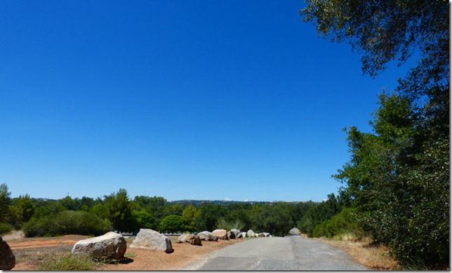
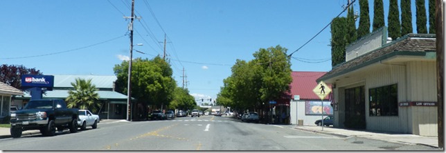
Since we are in Loomis, I thought I would do a quick posting about this little city.  Loomis has a population of just over 6,000 people, covers 7 square miles, and is at an elevation of 400 feet.  I tend to think of it as being near the foot of the Sierra Foothills.  Essentially the Sierra Nevada Mountains run along the Eastern side of Central and Northern California.  The foothills are the buffer between the large mountains, which run into the 12,000, 13,000 and even 14,000 foot range, and the Sacramento and San Joaquin valleys, which have elevations near sea level.  Loomis, at 400 feet, is too high to be valley, too low to be foothills.  Below is look to the north just on the outskirts of the city.

1a

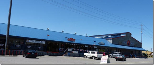
The Union Pacific Railroad tracks run right through town on their way up to Donner Pass over the Sierras.  The elevation is just right for growing fruits, and for well over a hundred years fruit packing sheds were located right along the rail tracks.  Today these old sheds have been converted to various office and business locations.

1b

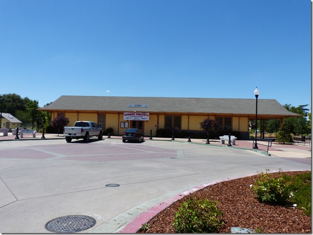
The train freight house and depot was built in 1910.  No longer used for train service, it is used for various community events and activities.

1c

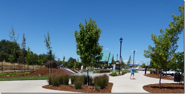
Next door to the old train depot is a park and a skating and skateboard park, and when I drove by, there was a lot of action going on there.

1d

Loomis is named after James Oscar Loomis who settled in the area and at one time was the saloon keeper, railroad agent, express agent, and postmaster.  He died in 1895, five years after the town was named after him.  Prior to that it was known as Placer, Smithville, Pino and Pine, however it never officially incorporated until 1984 to protect it from being taken over by the nearby, and fast grown city of Rocklin, which is located to the south of Loomis.

2b

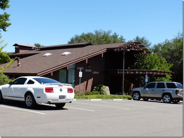
It seems like a nice little town, very friendly, family oriented, and has a nice size Public Library, located on Library Lane.  (Gotta throw that in since I am a former Public Library Director myself.)

2c

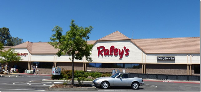
Oh, and we sure appreciate the nice, big Raley’s Supermarket in town.  I have been going to Raley’s since before I can remember….a great store….almost as nice as Publix in Florida.

2d
Follow my blog with Bloglovin

Sunday, June 23, 2013

Family Time

It has been so nice to just be with family over the past three days.  Most of our time has been with mom and dad, but we have also seen my two sisters, a brother-in-law, an aunt, a cousin and her daughter, both of whom I had not seen for 20 years or more and just happen to have been driving through town on their way back to Idaho.  Seeing a brother on Monday and his wife, and another brother I plan to pop in at his work sometime this week, and another cousin who lives very close to mom and dad.  Then I need to make some time to see some friends… and mom asked us to drive them down to the Modesto area to visit with her only surviving sister.  (Mom was one of eleven children, ten of which produced off-spring, the one who did not died in combat in the Pacific during WW2.)

Today we attended Metro Calvary, a church which we attended many times last year while we were in the area.  The big treat this year is that our own home branch, Calvary Chapel of Palm Harbor, offers their services live over the Internet (audio and video), and we got up at 6 am to watch it.  It helps us to feel a part of being at home in Florida, without having to face the high humidity and high temps (here we just have high temps).

And yes, we will be visiting and blogging about places in and around Northern California when we decide to go out and visit an area.  Definitely going up Highway 1 between San Francisco and Fort Bragg, definitely going back to Yosemite, have a few other ideas brewing.....  But right now…. it's family time…. and we are enjoying the heck out of it.

Friday, June 21, 2013

Two Happy Happy Happy Dogs

1a

LOOK, there are TREES again!  Looks much better than what we had been looking at for the past few days in Nevada….as shown below.

1b

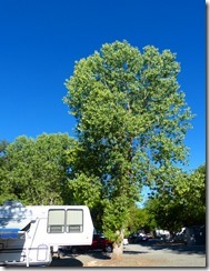
And when you are a Dog, you know that trees just offer that many more opportunities for SMELLS…  So yes, we made it to California Thursday.  We got set up in the RV park that we will be at for the next two weeks….it is an old KOA (yawn) full of gravel (double yawn), with lots of trees (clapping) and only 15 minutes away from mom and dad (double clapping).

1
July 2012...missing Arny Treats

So last night we went over to mom and dad’s for dinner and visits, then over to my sister’s house where we stayed last year for a few months because the dogs were just dying for a familiar backyard to run around in, and for an Arny Treat from their uncle Arniy (last year’s post on Arny Treats).  In a few weeks we will be back in my sister’s backyard, but they are currently doing a remodel project and the RV pad is taken up by a storage pod.

2a    2d

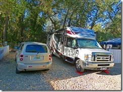
Now for Loomis RV Park.  Having trees is nice….but a little grass, and more distance between RV’s would be even better.  At $215 per week, not a bad California price, but a little bit of privacy would have been nice.

2b  2c

At least we will like our neighbors to our rear….oh, there are no neighbors there….exactly the point.

3a

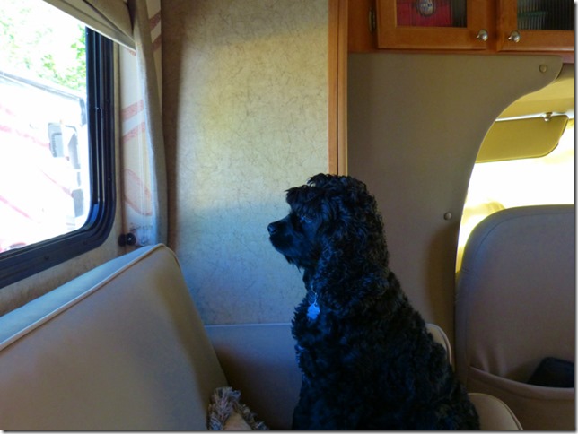
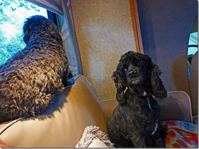
And I know we will be safe because we have two special guards….one on each side on a constant watch for anything that moves…and the frequent bark from this one, and rare bark from the other one, we will always be safe with watchdogs like this. 

Wednesday, June 19, 2013

Laundry, Grooming, Non-travel Day, Invite to NEW Google Maps

1a

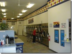
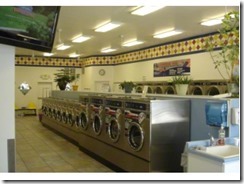
Doing laundry was first on our list today.  Research before we even got to the RV Park showed that this laundry mat, Soak n Suds, was located just across the highway.  A quick surveillance run first thing this morning showed me that it was going to be a real winner….and true to form, Marcia did really like it.  Now I love our camera, but I did not dream of taking it with us to do laundry….so I got these three off the Internet.  I wish all the laundry mats were as clean and nice as this one!


1b     1c

Next, time to groom the dogs.  Poor Bubba was in real need for a buzzzz job.  Below is a picture from a few days ago.  His last grooming was a little over two months ago…with the American Eagle break down, unpacking the condo, buying a new to us Class C, and taking off last week, poor Bubba just did not get his monthly grooming job, and was looking very shabby.

2a

So today I removed the scooter from the back of the HHR, laid down a old piece of carpet, sat on the scooter and gave him his buz.  It took a couple of hours because his hair is so very thick…and he got tired of it all, but he is now trimmed down.

2b

Marcia thought I should have trimmed his head more, but then he looks like a big rat….I just had to leave his ears and head long, although I did trim both, and I cut his face back too.

2c

Skruffy on the other hand, she was groomed about three weeks ago, so today she got a good, quick trim.  You can see it in Bubba's face, he does not understand why he was under the knife, I mean clippers, for two hours, while she was done in 15 minutes.

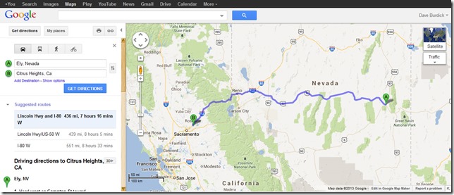
OldGoogleMaps

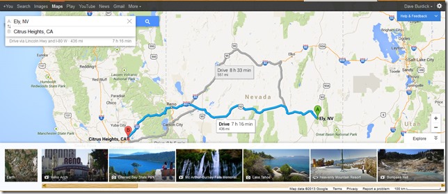
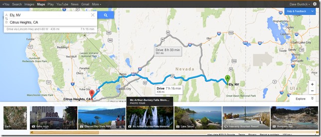
Don’t know why, but Google gave me an opportunity to try their “New Google Maps”.  I had just read about it this morning in the news, and so I decided to give it a try.  Above is the old maps giving directions from here to Citrus Heights.  Below is the new…. Remember, you can click on the picture and it will show a larger version.

NewGoogleMaps

What I like is the bar along the bottom giving a set of pictures (with more to the right out of view which are available in the live version by moving the bar along the bottom). Also like how alternative routs are shown in "grey", and there is an option to see how many miles each route would be.


NewWithSuggestion

Above I put the mouse over the suggestion of “Burney Falls”, and it draws a line to where Burney Falls is located.  Now that is neat.  I am unsure of when it will be offered as the standard map, and I have just begun to look at the features.  It sure looks like a great resource to me…especially the suggestion bar of places to see..

Don’t know about tomorrow….as Scarlett says in Gone with the Wind, I can't think about that right now. If I do, I'll go crazy. I'll think about that tomorrow.

Monday, June 17, 2013

GREAT Father’s Day with Steph, Bad RV park, on to Ely Nevada

Did not get a chance to take a photo at Fort Bridger RV Park for the last post, so here it is…. nothing fancy, but sure was a quiet park.  The park in Draper is not worth showing a picture of, but that part of the story will come in a bit....
1a
We left for Salt Lake around 9:30, gassed up in Evanston, and headed down I-80.  As we left Evanston I saw an advertisement for a Blue Beacon Truck / RV Wash. Having had luck with them washing the American Eagle, I figured what the heck….Marcia can treat me to a Father’s Day RV/Car Wash, and it was great.  For something like $50 they washed the RV and the HHR, and they put RainX on the RV.  It sure looked pretty again, and all I had to do was drive it in and drive it out.  Smile
1c
Back to our drive to Salt Lake area.... We quickly entered Utah, and very soon saw some of the reddish rock that Utah is know for. The drive down to Salt Lake as fairly easy, the “trailer tow” switch helped break, and at times I used the normal brakes to get us down to 40 mph again just to have the steep downward grade slowly get me back up to 55-60 again.  My RPMs hit 4000 for a very short time period, but most of the time was under 3500, which I feel is very safe to run with this Ford Triton V-10 engine.
2a
Above is a google maps image of Mountain Shadows RV Park in Draper Utah.  Now we have not had any problems with any RV park that we called only a couple hours away from arriving.  The young man got much of my information, and could have got credit card info from me, but did not even ask.  He told me that we would have a pull-through, 50amp and they had a conversion to 30amp if needed, but I told him I had one.  We estimated our arrival at 12:30, and got there at 1:00….just to find out that they were full, and we could only have a “water/electric” only site along the front fence.  He tried to say that I had complained about the 50 amp, and this would be 30 amp, but I'd have none of it.  Since this was near Steph, we took it, and it was 1/2 price…but it was not what we had bargained for, that is for sure.  We were just about where the blue balloon is located in the picture.  A small trailer pulled in between us and the pop-up trailer that we were next too, squeezing in tighter than a beer belly Bear’s fan in a Number 9 Jersey (still dreaming of the golden days when Jim McMahon led them to their last super bowl soooo many years ago…..now I am in deep Skata with Marcia, a die hard Bears fan.)  On the other side of us there was lots of room, but they had this guy put his little trailer in this little spot....they could barely get their door open without hitting our slide out.
1DaddysPrincess
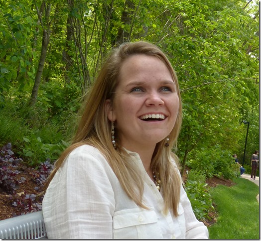
Above is a picture I took of Stephanie in May at Ryan’s graduation.  I did not even think of taking one yesterday, so this will have to do.  She came over to the RV Park around 2, and then we took her to lunch, and then went back to the RV where we visited until 10:30.  I cannot remember the last time I saw her on Father's Day, so it was a special treat.  Speaking of special treat, she tried a few times to take us out for ice cream, but I told her that she needed to save her money for registering her car and getting into an apartment (she currently lives with a cousin and watches their small children in exchange.)  But I sure appreciated the thought....and I did enjoy our visit tremendously.
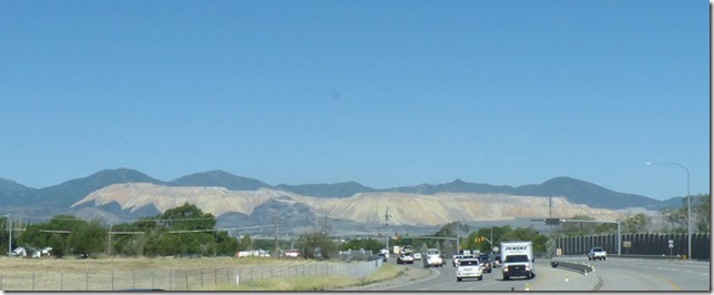
3a
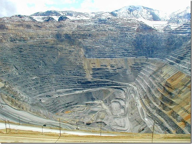
As we left the RV park today headed for Ely, Nevada via the east-side of Utah Lake, the Kennecott Copper Mine was in plain view.  The Mine has been in operation since 1906, and was for many years the largest open-pit mine in the world.  When it started it was called, and still called by some today, as the Bingham's Canyon mine.
3b
Above is a picture from Wikipedia showing the inside of one portion of the mine.  When one flies into Salt Lake City and the landing is “south to north”, the mine can be seen outside the left side of the airplane.
4a
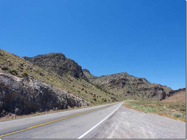
We took highway 68, also known as Redwood Road, along the west side of Utah Lake.  Provo/Orem area, where BYU is located, is along the east side of the lake.  The last time I drove this route must have been 25 years ago, and now there were many big homes along the route half way down the lake….then it becomes the normal Utah desert look.  It is amazing how much the Salt Lake and Utah Valley area keeps growing and growing.  The picture above is along highway 6 before we reach US 50.  The elevation here was around 7000 feet.  We traveled up and down along the road the entire day, hitting a low of around 4200 feet.  Ely Nevada is around 6500 feet.
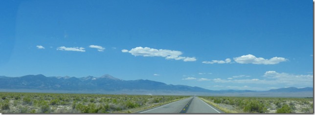
5a
As we near the Utah/Nevada boarder, you can see the mountains of Great Basin National Park to the left of the road.  We are thinking of visiting there tomorrow after we do our laundry….but we will have to drive 60 miles back just to reach the road leading to the park.  There was an RV park along US 50 near Baker…..but it was a dust bowl, so we passed.
6a
Here is our spot at the Prospector Hotel & Casino RV Park in Ely Nevada.  I think we have the best spot in the park since we have the most shade.  It cost $15 per night, and includes electric (even 50 amp for those who need it), water, sewer, and free, fast Internet -- but no cable TV (lots of over the air TV though).  You even get access to the swimming pool and spa, but we don't plan to use them.
6b    6c 
Ok for $15, and the laundry mat, which looks like it is only a few years old, is right across the street. This will be an ok stop for two nights, then we will continue our journey to the Sacramento area to visit family.   

A little tidbit about Ely….  It was a former stagecoach and pony express stop. It was later a copper mining community, and today, with the advent of cyanide heap leaching, gold is also mined.  The copper ore taken from Ely is shipped via rails to Seattle, and then by boat to Japan for smelting. 

Sunday, June 16, 2013

More Oregon/California/Mormon/Pony Express Trail(s)

1a
We were up at out of the RV park by 7:30.  As we headed West-Northwest on highway 26 we can see the mountains (Laramie Peak, Eagle Peak, Bear Head Mountain, etc).  Could not see the top of the larges one, however, which I think is Bear Head Mountain.
1b
We soon hit I-25, and another view of the mountain range showed the many peaks of the various mountains.  One could certainly see why the early pioneers would travel so far north to go around these monsters.  Look at the terrain in the foreground….they had lots to deal with.  The line of trees to the left is the North Plat River just north of Glendo Reservoir. I-25 is just starting to take a large left turn to head west to Casper before it cuts due north to Buffalo Wyoming. 
1c
We went through Casper and caught highway 220, and continue our path along the wagon trails.  The highway was under construction near Casper, but there were no delays and enjoyed the fresh, new asphalt to drive on, and the red look of these mountains.
1d
Eventually we came upon Alcova Reservoir, which was built in the 1930’s, and is supplied by the North Platt River.  I am sure that the Pioneers would have loved a lake this size to play and clean up in…but alas, they just had the river.....let alone have a house like this one to live in with that view.
1e
Our journey continued toward Independence Rock, which is up by those mountains ahead.  Below you can see more of the terrain that the pioneers had to deal with.
1f
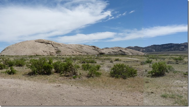
We finally made it to Independence Rock.  There is plenty of RV parking, and truck parking, and car parking because this place also doubles as a Rest Area.  There are plenty of informational signs, you can take a short walk up to and around a portion of the rock, and most of this walk was along concrete sidewalks, which was good for Marcia who was on her little GoGo.
2a
Many a pioneer signed their initials or names into the rock….most of which have long disappeared. 
2b
Above is probably some carvings which were from the 1800’s, but the “J” and the “B” are probably from the 1900’s.  But there was no one around to ask, so it is up to each person’s own judgment.
2c
Around the back side of the rock you come upon these various plaques.  You can click on the image to enlarge it (remember to come back to the blog though), and most of the carvings on the rock are from the early 1900’s, though some fainted ones can be seen in the area which definitely look like they are from the early pioneers.  Regardless, it was nice to see Independence Rock, and it made me think of my third great grandfather Jacob Willis (on my dad’s side) who brought his family to Oregon along the Oregon Trail around 1847.  He and his wife Mary Ellen had four children born in Missouri, and one born in Oregon.  Jacob died soon after they arrived in Oregon, probably before the birth of his last child.  The oldest child, Sarah Anne, was my second great grandmother, and was around nine years old when they traveled to Oregon.  One has to wonder if she ever played on or near Independence Rock as so many of them did. 
3a
We made our way down to I-80 at Rawlins, and traveled the “familiar to me” I-80 to Fort Bridger near Evanston, a few hours away from Salt Lake City.  I don’t know how many times I have traveled along this route….mostly in the first 30 years of my life when I lived in Sacramento.  Cities are bigger, the road is in fair shape, and the wind always seems to blow along I-80 in Wyoming. We are at the Fort Bridger RV Park, a Good Sams park which is nothing to write home about, but is going to make for a quiet night's sleep.  Good Internet, 14 channels of cable, and we did not have to unhook the HHR...but the price is twice that of last night's Passport park, and this place is not much better than what we had last night.