Around 10 am, we went over to get mom and dad and we headed to Lake Tahoe. We decided to drive up I-80, and we will come back using US-50. Both are very scenic routes, and by going along I-80 it gave us a chance to show Marcia where the Donner Party stayed during the terrible winter of 1846/47. Eighty seven members made it to Donner, and only 48 made it out. If you wish to learn more, visit the Wikipedia page on the Donner Party, the story is a long one, which started during the spring of 1846, as nearly 500 wagons headed west from Independence....the Donner-Reed party at the back of the wagon train.
Above is Donner Lake as we drove along old Highway 40, which goes right by the lake. Below is a view from I-80, which the faster route today.
Above is picture of the Donner Monument from the roadway, while below is one off the Internet showing the front of the monument. They were doing work on the area around the monument, so we could not drive up to it. The pedestal that figures are standing on is 22 feet high, which is how high the snow was that winter in the area when the Donner Party was stranded.
Below is a view of the railroad going over Donner Summit. The tracks are enclosed in a wooden tunnel, and there are also tunnels through the rocks. Donner Summit constituted by far the most difficult engineering and construction challenge of the entire original Sacramento to Ogden Central Pacific Railroad route.
Below is a picture of the old US-40 bridge. Much of the route now is now unusable, but some portions have been saved as "historic highway".
We then went to the town of Truckee for lunch, where we ate at this quiet, but nice, coffee shop called "Coffee And", they serve breakfast, lunch and dinner.
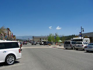
We all enjoyed our lunch, and before we headed out, I took a few shots of the old downtown area.
We then headed towards Lake Tahoe along highway 89. It goes right by Squaw Valley, the site of the 1960 Winter Olympics, and the one and only place that I snow skied...and where I broke my right hand in the process. Soon we were driving along the western portion of the lake, and oh what a pretty site...
Driving along for another 30 minutes or so and we came to the Emerald Bay area. This is the only island in Lake Tahoe.
Below, Marcia, Dad and Mom look over the bay at a vista point.
On the island, as you can see in the close up below, there is a small castle looking building. They call this the "Tea House".
The island is named Fannette Island. Fannette Island was the home of Captain Dick Barter from 1863-1873. The eccentric captain had moved from England and built his own tomb and chapel on the island. He was never interred in the chapel he built, as he died in a storm and his body was not found. Man may plan, but we cannot override that which the Good Lord has in "HIS" plan. The "Tea House"was constructed by the owner of Vikingsholm, a 38-room mansion at the heart of Emerald Bay.
Above is my picture of Vikingsholm from afar, and below is one from the Internet. Vikingsholm was built by Mrs. Lora Josephine Knight as a summer home.
Some parts of the structure contain no nails or spikes, as a result of
old-fashioned construction methods. Most of the building was made from
materials found at Lake Tahoe.
And as we drove on, we saw Cascade Creek Falls off in the distance with snow capped mountains above it.
Tomorrow we plan to drive to Virginia City in Nevada, and then we will have dinner at the top of Harrah's at North Shore also in Nevada. They have a wonderful buffet, including the best desert bar around.


No comments:
Post a Comment
We love to hear comments from our readers. All comments are moderated by Dave before added to the website. Spam, advertisers and rude comments are deleted, and due to high spam attempts, Anonymous Users can post, please register for a Google ID, it is free and it is easy. Go to: Get Google ID