Showing posts with label Green River. Show all posts

Tuesday, August 9, 2022

To the Coolness of Colorado


Our stay in Green River was HOT!  Without shade, the motorhome struggled to keep the inside to a reasonable cool feeling, and sitting out in the shade did not make it any better.  Let alone, our little Indy Girl was not happy about the patch of grass we camped next to...not happy one bit.  Perhaps another park nearby might have more shade...but it was only for two nights, and the nights cooled down around 1 am.  YUCK!

After getting gas at $4.85...(amazing how the nothing town of Salina Utah was down to $4.18!), we headed east on I-70 for 25 miles, then south on to US-191 towards Moab.

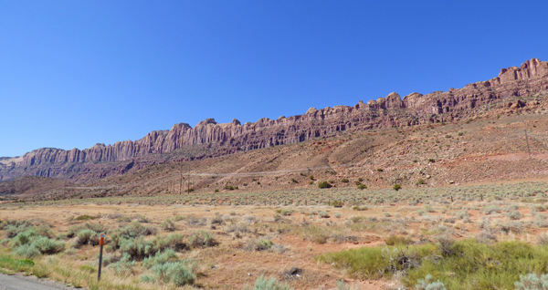
Quickly off in the distance you can see the northwest tip of Arches National Park.


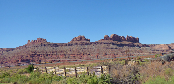
The closer you get to Moab, the prettier it gets.  The only complaint that I have, and I have had it for years, is the ...

... Power Lines and Power Stations that interfere with the view.  If you look close above, there are power lines along the entire bottom of the pictures...you can certainly see them at the bottom left of the picture.


And this picture here has a train, and the power lines in front of this gorgeous mountain.

Here is the entrance to the park.  Been to Arches around a dozen times in my lifetime, it is a very eye-catching, interesting, scenic park.  Although we considered going again this time, we did not want to add the 3-4 hours more to our drive into Colorado, and it was just too HOT to stay at a park in Moab.  Marcia has been to Arches 3 different times...so we did not feel it was worth it again.   The first time I took Marcia there it was totally a surprise to her.  We had been married for less than a half of a year, did not have our first motorhome yet.  Came to visit my daughter in Salt Lake City, and on the way home I choose the road through Moab.  As we left the park, being there for a mere 3 hours, Marcia calls my mom...the conversation went something like this.

"Hey ma, you know what your son just did to me?"

[I gulp]  Mom says, "I can't imagine..."

"He just took me through Arches National Park!  It is so gorgeous!"  [I wipe my brow]


The views in and around Moab are breathtaking...I guess that is why the town is growing in population...up by 35% since 1990.

We did drive by one arch, Wilson Arch, which can be seen in the middle of the picture above, and more easily in the picture below.


Beyond that are even different rock formations.  We did not get a picture of the Hole in Wall, one of the 'many' Hole in the Wall landmarks in Utah, one of which is certainly Butch Cassidy's Hole in the Wall.

We arrived at our destination around 1:30 pm, Target Tree Campground, a San Juan National Forest campground.  It is about 20 miles east of Cortez, at 7,600 feet.  Yes, we have shade.  It is currently (5:00 pm Tuesday) at 79 degrees, and it will be down in the mid to lower 50's tonight.  That is pretty much the forecast for yesterday, today, tomorrow...etc.   More about the park in tomorrows blog.


Saturday, August 6, 2022

To Green River Utah


Although it takes longer to go across US-50 than it does I-80, I love '50' much better.  You still go through all those towns, you drive through the cities, you see the old landmarks like the Nevada Club Casino in Ely pictured above.  And today we were blessed with some rain...

...and cooler temps due to the rain.  Yes, it did get up to around 85 but it was pretty cool for most of the day.


This part of Nevada has a bit more trees which adds to the scenery...or lack of, depending upon how you look at it.  The clouds make for even a more dramatic look.

RANT:  We stayed at a place called Border Inn Casino right at the Nevada Utah Border along US-50.  All indications from other blogs and reviews showed that the price was $25 per night, full hook-up, which included WI-FI and some reported ok Verizon coverage.  Well, when I checked in, after they ran the card, I found out it was $50 a night plus tax.  I looked at the lady and said, "I thought it was $25 per night?"  The reply was, "We have new owners, they raised the price."  Ok, so where is site #6 (our assigned site), and she replied, "They are all clearly marked out there...should be along row number one."  Meanwhile, an older lady asked the clerk why the 213e Park credit card machine was so far back into the staff area, and she had to nearly hand the credit card machine to the use to get them to scan their card.  The clerk shrugged her shoulders, the older lady said, "We will have to look into changing that..."   All the while this same older lady heard me question the price, heard the clerk tell me to go find my spot on my own, and there was no question about any of that!  Well, being so tired from the past few days, we paid that price, and used as much electricity and water as we possibly could without wasting anything.  As for the park, it is on dirt, it is half full of what I would call Mobile-home Trailers, and there were five other real RVer's, could have been six but that lady drove off when she saw that she had to run her water and electricity all the way from the front of her truck to the back of her trailer she was hauling.  Oh, and the Verizon was nonexistent, and there was no WiFi.  So we had no TV, no WiFi, no Cellular Data (but we did have phone...it was all roaming), and thank goodness we had a collection of DVDs just for the occasion.  We would NOT recommend this park at all due to the rudeness, lack of service, and lack of caring for the needs of the paying customer.

The first 80 miles from the border to Delta Utah was a bit boring...60 miles of no Internet, it took 50 miles before the clock automatically changed on our cell phones, and we might have seen a dozen cars/trucks going the other way during this part of the trip. 

As Delta got closer, so did some nicer scenery.  We stopped along the Highway in Delta to check our email, basic Internet stuff, and take care of business.  Too bad Indy had no where to go, so we waited until we found a better spot between Delta and Salina at a truck stop that almost had grass.


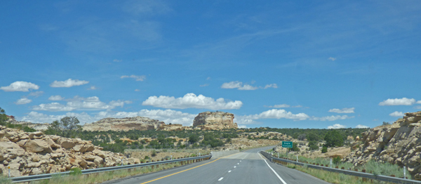
Between Delta and Salina, where we pick up I-70, we saw many green fields, lots of cattle, and a few rock formations that caught our interest.  But it was AFTER we got on I-70 that we were awed.  In my opinion, I-70 from Denver to Salina (perhaps all the way to I-15) is the prettiest INTERSTATE in the nation.  Yes, there are better highways, but not better Interstates in my opinion.  Here is a long series of pictures that tell the story.


As you can see, the views along I-70 are wonderful.  Elevation ranges from 4,500 feet up to 7,200 feet and back down again.  Many moments of using our lower gear, and many moments of using overdrive to slow us down as we headed down the 6% grade.  All the while, trying to keep my eyes on the road and not the scenery...which is impossible to do.

We left the Nevada border right at 7 am, which quickly turned to 8 am Utah time.  We arrived at the iCamp Green River RV Park and Campground at 1:30.


The price is the same for this park as the one in Nevada, BUT the attitude and helpfulness of the staff is a 100% turnaround.  Asked for a Water Electric pull through with shade.  The lady says, "This is the best we have, but there is a back-in site which has good shade.  Not wanting to hook up on Monday morning, I took the best site they had.  Shade hits around 5:30, which means the heat of the day is right there on us.  The new AC that we have kept us at 80-82 degrees with outside temps hitting 99 degrees.


The A-Frame building is indicative of it being an older KOA.  Likeother older KOAs, they choose to use the "iCamp [name of town or area]".  This is our second or third one we have stayed at now. 

Indy is happy that we have stopped...and she will be even happier when we find grass again!  So far the trip is going well...no problems with the motorhome or the HHR tow car.


Thursday, June 15, 2017

Flaming Gorge National Recreation Area

Flaming Gorge at Red Canyon Visitor's Center

Many times while traveling along I-80 I had seen signs about Flaming Gorge, and I always wanted to see it.  Well, last week with our change of plans in heading to California early due to my aunts death, I awoke in the middle of the night and said to myself, “Why go further east into Colorado?   Why not visit Flaming Gorge, then head west to I-80 near Fort Bridger, and on down to Lake Jordanelle.  So the next morning, after going back to sleep and having a good night’s sleep on it all, I showed Marcia my plan, and so we decided that after Black Canyon, go up to Flaming Gorge and spend most the weekend, heading down to Jordanelle on Sunday.  Above is the view of the Green River from the Red Canyon Visitor’s Center area.

US 191 between Vernal and Flaming Gorge     US 191 between Vernal and Flaming Gorge
First, we caught US 191 from Vernal up to the Gorge area.  US 191 heads to the east side of the Gorge at this point, but we were headed to the west.  US 191 is the same highway that goes through Moab and Monticello, and near Goosenecks, places we have been before on this trip, or on others.  Very quickly we start to see more rock cliffs and the road, though a bit bumpy, is lightly traveled and very scenic.

US 191 between Vernal and Flaming Gorge

We start up the Uinta Mountains, an east-west trending chain of mountains in northeastern Utah extending slightly into southern Wyoming, the highest range in the contiguous United States running east to west (west 100 miles to Salt Lake City).   The highway nears the 10,000 feet elevation mark in two places in Utah…near Price, and between Vernal and the Gorge.  GULP…  But first we pull over at nice turnout and get a panoramic looking south.

US 191 between Vernal and Flaming Gorge

Red Canyon of Flaming Gorge National Recreation Area is only 35 miles or so from Steinaker Lake State Park, but with climbing 3,000 plus feet going over the Uinta Mountains, it takes us over an hour.  Here is our first view of the Gorge area…you can faintly see some blue water in the middle of the picture.

Flaming Gorge at Red Canyon Visitor's Center
Flaming Gorge at Red Canyon Visitor's Center    Flaming Gorge at Red Canyon Visitor's Center

There is a nice little Visitor’s Center at Red Canyon, along with a couple of National Forest camping areas…no nothing in the camping areas except pit toilets.  The exhibits are nice, we watched one of the many short movies they have available, and of course, the view out the windows of the Green River flowing slowly, due to the dam, through the Gorge.  Seems like you can see for a hundred miles!  (We will be visiting the dam another day, so I won’t go into that right now.)

Flaming Gorge at Red Canyon Visitor's Center

Outside there is a pathway that Marcia and easily navigate the GoGo on.  There are numerous viewpoints, most of which she can “see somethings”, but a few have rocky areas and that view just is not available to her.  After getting the first picture in this post way above, I see a boat out in the water and get this picture.  Look at the reflection in the water of the red cliffs…

Marcia at Flaming Gorge at Red Canyon Visitor's Center
To the left you can see Marcia scooting along the pathway.  There are various information plaques along the route telling you the Marcia at Flaming Gorge at Red Canyon Visitor's Centernames of trees, information about animals, and other good stuff like that.  But the best thing is the overlooks…the wonderful views of the Gorge.  I was just elated that Marcia was able to enjoy the views at the Red Canyon area.  The temperature was right at 70 degrees, the dogs stayed in the motorhome, so we did not have to worry about them.  And there were just a few people around…no crowds…little noise except for birds and little ground squirrels or chipmunks…and having to dodge a few butterflies as you walked through certain areas.

 Flaming Gorge at Red Canyon Visitor's Center
 Flaming Gorge at Red Canyon Visitor's Center      Flaming Gorge at Red Canyon Visitor's Center

The River/Gorge takes many turns, and along the walk it goes around this point (top picture), and you can see the view to the north (above left) and to the south (above right). 

 Flaming Gorge at Red Canyon Visitor's Center

We really enjoyed our 90 minute visit to Red Canyon…but it was time to move on and try and get a camping spot for four days.  Our goal was along the Utah/Wyoming boarder in a place near Manila Utah…a large National Forest Campground called Lucerne Valley Campground.  There were many views along the way…those we will show in future posts as we go back to visit the dam, take the Sheep Creek Canyon Geological Scenic Loop, and just enjoy the area.

Lucerne Campground, Flaming Gorge
Thank goodness we landed a camping place through Saturday…four nights, electricity, $78 with senior pass.  Now we could have stayed at other NF campgrounds, but without electricity, much cheaper.  Lucerne Campground, Flaming Gorge -- Rig looking like oursBut with temps falling into the lower 40’s for the next few nights, having electricity means we can use our electric heater that makes no noise.  Besides, we found our near twin just one loop to our west!  I recognized the lady coming out of the other Isata, this one with a door towards the rear, as one of two ladies who walked by our motorhome earlier in the day staring and pointing.  Now I can see why they were gawking.  But they were not the only ones walking around the campground today….

Pronghorn, Lucerne Campground, Flaming Gorge

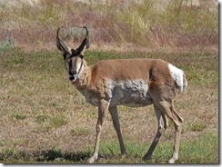
These two male Pronghorns were the first ones to come by today…opened the door to take the dogs out, and there they were. 

Pronghorn, Lucerne Campground, Flaming Gorge     Pronghorn, Lucerne Campground, Flaming Gorge

I had read that Pronghorns wander around the park at ease.  Later we saw a female walk by, and even later I got a picture of two more…but they might have still been these two.  It was near sunset, and they were down in a few loops away.

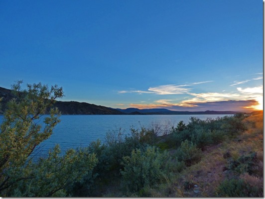
Sunset, Lucerne Campground, Flaming Gorge

Oh, it is going to be a nice four nights here along the Green River….tomorrow (Thursday) be dam.