Showing posts with label Lucerne Valley Campground. Show all posts

Saturday, June 17, 2017

Sheep Creek Canyon, Flaming Gorge

Sheep Creek Canyon Geological Area, Flaming Gorge

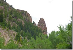
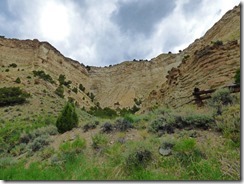
Today we took our scenic drive along Sheep Creek Canyon, a 13 miles loop that we took about 5 miles south of Manila (Manila is 8 miles south of where we are camping) off highway 44, and it loops back to highway 44 about 7 miles from where we exited the highway.  In total, it was just about a 50 mile ride.  It is known for two things…great Geological formations and changes, and wildlife.  We saw the first, but other than little creatures (rodents) skirting across the road and some birds, we saw nothing of the wildlife.  In fact, we liked it so much, we did it twice…first from 11:30-1:30 and a second time from 5:30-7:30, but in the opposite direction along the loop.  As I have said before, be sure to click on the pictures to see larger ones…especially this one above…the swirls in the mountain and various colors are a sight to see.

Sunset, Lucerne Valley, Flaming Gorge
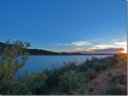
First, last night Skruffy and I drove west from the campground towards the highway, where there is a scenic overlook looking over Linwood bay…where the town of Linwood once stood until the government bought all the land so that the reservoir could fill the area where the town once stood.  This town was a border town…half in Utah and half in Wyoming.  The school was built right on the state line, so funding came from both states.  By the early 1950’s, the town was pretty much drying up…although the post office operated until 1958.  They demolished or moved all the old buildings, and it is now covered by Linwood Bay, part of the Flaming Gorge Reservoir. 
Sunset, Lucerne Valley, Flaming Gorge       Sunset, Lucerne Valley, Flaming Gorge

I always look to the east (picture left) and to the north (picture right) or south to see if the sunset is bringing color to the areas surrounding where I am…hit two of three with this sunset…the view to the south was a bit boring.

Sheep Creek Canyon Geological Area, Flaming Gorge11 of the 12 miles is paved…they are working on paving the final mile.  There are a few areas where you have pot holes, but very few.  For the most part, it is a very good road to drive on, don’t expect to go over 25 mph on most of it.  There is a climb, or drop depending on which way you go, of nearly 1,000 feet which covers about 2 miles of the route.

Sheep Creek Canyon Geological Area, Flaming Gorge    Sheep Creek Canyon Geological Area, Flaming Gorge

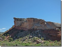
There are various signs which talk about the type of rock/dirt/sand formations, and there are online travel guides that you can get to take with you…but don’t expect any cell reception along most of the drive.  I am just going to post some pictures in the order we took them to give you an idea of how rapidly, sometimes, the look of the rocks change.  Sometimes it was drastically different on one side of the road from the other.

Sheep Creek Canyon Geological Area, Flaming Gorge        Sheep Creek Canyon Geological Area, Flaming Gorge

The weather was a calm 70-72 degrees, it was cloudy, but no rain…not even a sprinkle.  Unlike yesterday, we did not turn on the A/C in the motorhome, and for the most part, had the windows down while we drove through the canyon with the car.  Motorhomes “could” make the drive through the canyon, Class C motorhomes would have no problems, but anything over a 40’ Class A could have trouble with a few turns…but with little to no traffic it is doable.  We took the car.

Sheep Creek Canyon Geological Area, Flaming Gorge     Sheep Creek Canyon Geological Area, Flaming Gorge

Coming in from the direction we did (north entrance of the loop), you enter the canyon fairly quickly, and there is little elevation change.

Sheep Creek Canyon Geological Area, Flaming Gorge

Sheep Creek Canyon Geological Area, Flaming Gorge

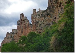
As you come out of the canyon, you start to climb, and of course, the road zigs and zags.  About half way up there is a large pullout, and you can look down into the valley and the canyon below (top picture above), or look up at the mountain which you still have to climb part way up before you go around it (bottom picture above).
Sheep Creek Canyon Geological Area, Flaming GorgeSoon you come to a dirt road turn off, and you have multiple choices of places to go.  We could have taken it to Browne Lake, but I was told at the visitor’s center at Red Canyon that Sprit Lake still had snow…4 wheel drive was advised for anything beyond Browne Lake.  Being that this was a dirt road, we did not take it, and continued on our loop trip.

Sheep Creek Overlook, Flaming Gorge

Back on highway 44, we start back for home.  There was one vista point that we had not visited yet, it is the Sheep Creek Overlook.

Sheep Creek Overlook, Flaming Gorge

One thing about Flaming Gorge, like the other canyons we have visited, there are so many twists and turns of the river below, that there are many many different views of the canyon below.  This area here is where the canyon starts or ends, depending upon how you look at it.  Where we are camping, it is more like a lake…where that mountain range is directly center on the other side of the water is where the beginning of the canyon is, headed to and past the dam.  Our campground is on the other side of that mountain, and a bit to the left.

Sheep Creek Canyon Geological Area, Flaming Gorge
On our return trip we did not take very many pictures of the mountains, but this mountain here is the same one as the first picture of this blog post, but from a different angle, and with different lighting.  I show it because this is the type of drive that you want to take going both ways, and at different times of the day. 

Tomorrow we head west to Lake Jordanelle for a few days, which makes it easy to visit my daughter down in Salt Lake City.  Then off to Sacramento for the Celebration of Life on Saturday for my aunt.

Thursday, June 15, 2017

Flaming Gorge National Recreation Area

Flaming Gorge at Red Canyon Visitor's Center

Many times while traveling along I-80 I had seen signs about Flaming Gorge, and I always wanted to see it.  Well, last week with our change of plans in heading to California early due to my aunts death, I awoke in the middle of the night and said to myself, “Why go further east into Colorado?   Why not visit Flaming Gorge, then head west to I-80 near Fort Bridger, and on down to Lake Jordanelle.  So the next morning, after going back to sleep and having a good night’s sleep on it all, I showed Marcia my plan, and so we decided that after Black Canyon, go up to Flaming Gorge and spend most the weekend, heading down to Jordanelle on Sunday.  Above is the view of the Green River from the Red Canyon Visitor’s Center area.

US 191 between Vernal and Flaming Gorge     US 191 between Vernal and Flaming Gorge
First, we caught US 191 from Vernal up to the Gorge area.  US 191 heads to the east side of the Gorge at this point, but we were headed to the west.  US 191 is the same highway that goes through Moab and Monticello, and near Goosenecks, places we have been before on this trip, or on others.  Very quickly we start to see more rock cliffs and the road, though a bit bumpy, is lightly traveled and very scenic.

US 191 between Vernal and Flaming Gorge

We start up the Uinta Mountains, an east-west trending chain of mountains in northeastern Utah extending slightly into southern Wyoming, the highest range in the contiguous United States running east to west (west 100 miles to Salt Lake City).   The highway nears the 10,000 feet elevation mark in two places in Utah…near Price, and between Vernal and the Gorge.  GULP…  But first we pull over at nice turnout and get a panoramic looking south.

US 191 between Vernal and Flaming Gorge

Red Canyon of Flaming Gorge National Recreation Area is only 35 miles or so from Steinaker Lake State Park, but with climbing 3,000 plus feet going over the Uinta Mountains, it takes us over an hour.  Here is our first view of the Gorge area…you can faintly see some blue water in the middle of the picture.

Flaming Gorge at Red Canyon Visitor's Center
Flaming Gorge at Red Canyon Visitor's Center    Flaming Gorge at Red Canyon Visitor's Center

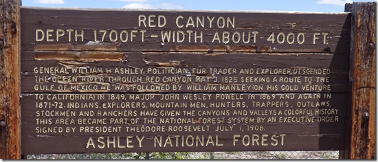
There is a nice little Visitor’s Center at Red Canyon, along with a couple of National Forest camping areas…no nothing in the camping areas except pit toilets.  The exhibits are nice, we watched one of the many short movies they have available, and of course, the view out the windows of the Green River flowing slowly, due to the dam, through the Gorge.  Seems like you can see for a hundred miles!  (We will be visiting the dam another day, so I won’t go into that right now.)

Flaming Gorge at Red Canyon Visitor's Center

Outside there is a pathway that Marcia and easily navigate the GoGo on.  There are numerous viewpoints, most of which she can “see somethings”, but a few have rocky areas and that view just is not available to her.  After getting the first picture in this post way above, I see a boat out in the water and get this picture.  Look at the reflection in the water of the red cliffs…

Marcia at Flaming Gorge at Red Canyon Visitor's Center
To the left you can see Marcia scooting along the pathway.  There are various information plaques along the route telling you the Marcia at Flaming Gorge at Red Canyon Visitor's Centernames of trees, information about animals, and other good stuff like that.  But the best thing is the overlooks…the wonderful views of the Gorge.  I was just elated that Marcia was able to enjoy the views at the Red Canyon area.  The temperature was right at 70 degrees, the dogs stayed in the motorhome, so we did not have to worry about them.  And there were just a few people around…no crowds…little noise except for birds and little ground squirrels or chipmunks…and having to dodge a few butterflies as you walked through certain areas.

 Flaming Gorge at Red Canyon Visitor's Center
 Flaming Gorge at Red Canyon Visitor's Center      Flaming Gorge at Red Canyon Visitor's Center

The River/Gorge takes many turns, and along the walk it goes around this point (top picture), and you can see the view to the north (above left) and to the south (above right). 

 Flaming Gorge at Red Canyon Visitor's Center

We really enjoyed our 90 minute visit to Red Canyon…but it was time to move on and try and get a camping spot for four days.  Our goal was along the Utah/Wyoming boarder in a place near Manila Utah…a large National Forest Campground called Lucerne Valley Campground.  There were many views along the way…those we will show in future posts as we go back to visit the dam, take the Sheep Creek Canyon Geological Scenic Loop, and just enjoy the area.

Lucerne Campground, Flaming Gorge
Thank goodness we landed a camping place through Saturday…four nights, electricity, $78 with senior pass.  Now we could have stayed at other NF campgrounds, but without electricity, much cheaper.  Lucerne Campground, Flaming Gorge -- Rig looking like oursBut with temps falling into the lower 40’s for the next few nights, having electricity means we can use our electric heater that makes no noise.  Besides, we found our near twin just one loop to our west!  I recognized the lady coming out of the other Isata, this one with a door towards the rear, as one of two ladies who walked by our motorhome earlier in the day staring and pointing.  Now I can see why they were gawking.  But they were not the only ones walking around the campground today….

Pronghorn, Lucerne Campground, Flaming Gorge

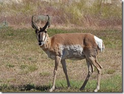
These two male Pronghorns were the first ones to come by today…opened the door to take the dogs out, and there they were. 

Pronghorn, Lucerne Campground, Flaming Gorge     Pronghorn, Lucerne Campground, Flaming Gorge

I had read that Pronghorns wander around the park at ease.  Later we saw a female walk by, and even later I got a picture of two more…but they might have still been these two.  It was near sunset, and they were down in a few loops away.

Sunset, Lucerne Campground, Flaming Gorge

Oh, it is going to be a nice four nights here along the Green River….tomorrow (Thursday) be dam.