Around 6:30 Tuesday night I went to one of our favorite gulf picture taking locations, Crystal Beach Florida. This is looking out to the west…the group of islands out there is Honeymoon Island State Park…beyond that is the Gulf, and those clouds out there are part of Hurricane Michael.
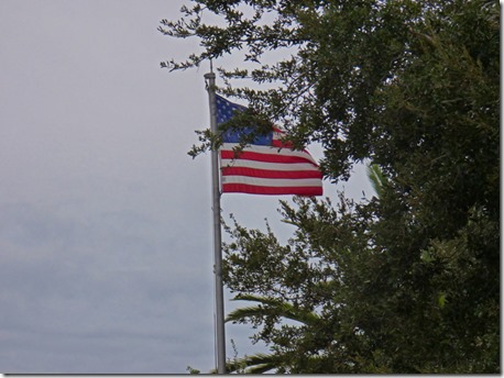
The flag at Crystal Beach, which is a community within Palm Harbor…not really a ‘Beach’ as one would think of Clearwater Beach, or other real beaches in our area…but the flag was flying due west, but it was a light wind…had I got the picture just 15 seconds earlier, the flag was still.
Last night we have a few downpours, had a constant 10-15 mph wind with a few gusts up in the 20’s to 30’s, and just a few downpours which lasted for very short periods of time…as shown in the picture above.
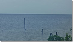
Marcia and I went back around 11 am today to see the difference between last night and today. Around 1:15 it will be high tide, and they are expecting another foot or so from what it was when we went by. Above you can see that the pole on the far left with a bird on it does not show up in the picture to the right…and in the picture to the right where a bird looks to be standing on water, it was standing on the pole which is clearly above water in the picture to the left.
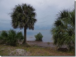
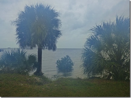
These two pictures above clearly show how much higher the water is. Now compare that to the same trees taken back in December 2016 below…
…the vegetation is much more mature today…but look at how low the water “normally” is! A vast difference.
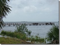
Here is the fishing pier taken today (left), and the same pier taken back in December 2016.
And this is what happens when you take your lens off in a air conditioned car, step out to take a picture in the 85 degree, 110% humidity … my eyeglasses did the same thing!
Here is an area in Tarpon Springs. The boat dock, which does not float, has only another foot or so before it is under water. The sea wall has about two feet before the water comes over it. Last night there was a fisherman here and I asked him how high it was last night compared to other times. He said that last year during the hurricane that passed through to the east of Tarpon Springs, that the water level was way, way down…the winds were pushing the water out away from shore, unlike the hurricane Tuesday which was to the west…it all depends upon which way the wind blows.
As I write this, the category 4 hurricane has hit the Mexico Beach area of Florida, just to the east of Panama City and Tyndall AFB, and just to the west of Port St. Joe and the Apalachicola River Wildlife area. Devastation is going to huge…wind and storm surge has never hit this area during our the history of our nation. The storm will do damage all the way up into Georgia..and in the Carolinas. By Thursday it will be in the Atlantic…leaving a wake of clean-up…and who knows how many deaths.








Glad you guys will be okay!
ReplyDeleteWe were planning on heading south through the Carolinas right along the same path that the hurricane decided to take. We move so slowly that we would not have been in any danger but it seems wiser to avoid the aftermath and stay away from the confusion of the cleanup. So we're on our way west!
Be safe...watch out for those fall tornadoes now.
DeleteThe hurricane passed about 100 plus miles to the east of us. We are very lucky, but many many folks were not. Many places we have really enjoyed appear to be gone or very badly damaged. Very sad.
ReplyDeleteYes, it is TOTAL devastation in and around Mexico Beach. Could have been worse had it been 50 miles closer to where you are, that is for sure. Lucky that people listened to the warnings here in Florida where the death toll could have easily been in the thousands had people not evacuated. I can't believe so many still stayed...say an interview of this guy who said they stayed to "try and save the house", their house was destroyed anyway, and next time they will leave for sure. That interview should be made into a PSA for future hurricanes.
Delete