Showing posts with label Chetco Bar Fire. Show all posts

Sunday, July 21, 2019

Busy Weekend Calls for Another Drive

At Alfred Loeb State Park, Brookings Oregon

Chetco River up river from Lobe State Park

Friday evening I took Skruffy for a short drive up river to get another shot from the Bridge of the Chetco River.  The lighting was different than last time, and the river was not moving much to the tides, offering a good reflection.


"What did you think of that little girl?"
"Dad, you KNOW I can’t see…why even ask that question??"
First time I had taken Skruffy on a little trip in awhile…she loves to go in the car, but she just can’t see that well anymore.  I can NOW pull up next to another car with dogs inside of it, and she is oblivious to them.  If it is not a bright sunny day she sees better…the darker it is, the more she sees especially if the target (ie: another dog) has some illumination to it.  She will be outside in the shade with me here at the park, and she has seen people walking their dogs, and of course, Skruffy will be Skruffy and she will bark.  If it is just people walking by (or kids on bikes or skateboards), she gives a small moan in anticipation of barking IF she sees a dog with them.  But out on a walk in the sun, dogs have gotten very close to us and she smelled them, but otherwise did not know they were there.
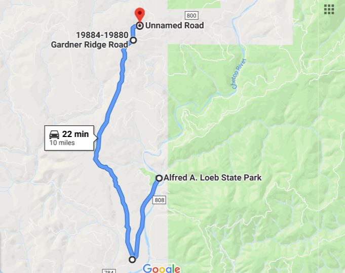

Yesterday, with all the action here at the park, I decided to go on another drive…this time I went back towards Brookings, and turned north on Gardner Ridge Road.  I knew that Gardner Ridge would eventually lead back into another part of the Chetco Fire area, but I was hoping I might find a hill tall enough to see the ocean…but to no avail on that idea.  After about 7 miles on Gardner Ridge Road, there is a dirt road off to the left, which I also took.  Google Maps shows that dirt road ending fairly quickly, but I know I went up that dirt road about 3 miles before turning around.  My guess is that after the fire the road has been added to, and probably connects to another dirt road that is also on Google Maps, all for the logging operation to rid the area of the burned trees.


After four or five miles on Gardner Ridge Road, which by-the-way was a lovely drive up to the ridge with a few scattered homes here and there, I started to see some of the devastation from the fire.


Eventually it was right up to the road, and went over the road…

…and off it went towards the Ocean -- over this ridge, down the next and onward.  Thank goodness they stopped it before it took out the communities of Carpenterville and Pistol River, both of which did evacuate around August 20th because it looked like the fire wasn’t going to stop until it hit the ocean.  As I said before, they did lose about 6 homes…a few of them were probably further down Gardner Ridge Road than I wanted to travel...but Google Maps shows some homes down that way, but they have not updated their maps since the fire.


Above is a wide-angle view of the area looking to the east, and you can clearly see where they (the fire fighters) stood their ground and stopped the fire from heading a more southwestern course towards Brookings.  Had the fire been allowed to just burn, there is no doubt that Brookings and all the way up to Gold Beach would have been taken out. 


Driving further down the dirt road, which was headed in a north-easterly direction from what I could tell, I saw this line of what looked to be lost crops (see arrow).


But they were not crops at all, they were burnt, downed trees that the loggers had put into these rows.  (picture has been magnified and is not as crisp as I like). 


As I continued down the dirt road, I came upon some more rows of these trees lined up right alongside the dirt road.  The rows of downed trees continue right down the hill off from the road…but I did not feel adventurous enough to walk out there and take a picture looking down the slope.


Eventually I turned around on the dirt road and headed back.  Here is a picture of Gardner Ridge, with the arrow pointing to the communication towers at the top of the ridge, and you can see the Gardner Ridge Road going through that green patch just off center in the picture. While on the dirt road, I did not see another car.  While on Gardner Ridge Road, I passed a few cars going the other way...very light traffic indeed.

When I got back to the Chetco River Road, I turned right towards Brookings instead of left towards Loeb State Park because the dirt road took its toll on the HHR leaving it covered with dust.  As I awaited my turn at the car wash, I texted Marcia to let her know where I was and that I would be running later than my 3 pm estimated time of return.  One thing I did notice while driving the Gardner Ridge Road is there are at least two turnouts where we could park overnight “IF” we get shut out from getting back into Loeb State Park.  On Tuesday we head north 30 miles to Gold Beach, but we plan to return back to Lobe four weeks later.  That would give us another two weeks, taking us through the Labor Day Weekend before we start back to California.  Lobe has been very busy so we "could" get shut out for a day, but I plan to be here early enough to make sure that does not happen…but if it does, we have a few alternatives, and Gardner Ridge Road is just one of them.


Monday, July 15, 2019

Checto Bar Fire – Two Years Later

At Alfred Loeb State Park, Brookings Oregon

Map of the 2017 Chetco Bar Fire

On July 12, 2017 the Chetco Bar Fire was first spotted, started by lightning.  A week later the fire had grown to 300 acres.  By early August, the fire had grown to nearly 3,000 acres, and then the wind took over.  By mid-August the fire had grown to over 20,000 acres, by August 24th it was over 100,000 acres.  It took into November before the fire was contained…burning over 191,000 acres.  That year we were here at Loeb Park from about the time the fire started through July 30th when we moved to Gold Beach.  We had not heard of the fire while we were at Loeb, but heard about it fairly quick once we got to Gold Beach.  Loeb is just northeast of Brookings (bottom left on above map)…Gold Beach is in the upper left.  By August 7th we were at Huntly Park northeast of Gold Beach.  By the 20th of August we decided the smoke was bad, evacuation notices were going out, and we decided to head north on Monday the 21st, then east to I-5, and eventually back to Citrus Heights.

2017 Chetco Bar Fire

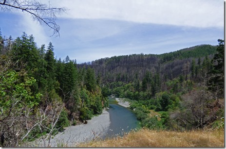
Saturday I drove over 15 miles from the campground and never did come to the end of the fire zone.  The devastation of the trees reminded me of the many areas we have seen that have had fire damage before….Yosemite’s Rim Fire, Yellowstone’s 1988 fire, and many others.  
2017 Chetco Bar Fire

2017 Chetco Bar Fire   2017 Chetco Bar Fire

The ride gave me a good idea of the fire’s magnitude along the North Bank Chetco River Road and National Forest Road 1376, but I could see that the fire continued northwest over the various ridges.  At mile marker 15 I turned back, and that is when I started taking pictures, so many of the pictures are headed south and west…I can’t remember what direction I was facing for all of them...sometimes I got out of the car, sometimes I did not.

2017 Chetco Bar Fire

There were a few areas where loggers have gone in and harvested some of the damaged trees…and this is an ongoing process.  They won’t be able to harvest the entire 191.000 acres, but many acres will be harvested.  Above is a picture of tree stumps where they harvested already.

2017 Chetco Bar Fire

2017 Chetco Bar Fire    2017 Chetco Bar Fire

2017 Chetco Bar Fire

There are many parts along the river that show little to no damage due to the fire.  There are a number of National Forest Campgrounds along the river ($10 per night, $5 with senior pass), and other areas that are free for day use and some boondocking, which may or may not be legal along the river outside of campgrounds.

2017 Chetco Bar Fire

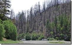
And yes, they park right up to the water.  The rocks along the bank are typically the size of a fist…some bigger, many smaller.  The bank is very hard…although the rocks will move, for the most part the rock bed is very hard, and cars, trucks, trailers move right along it.

2017 Chetco Bar Fire

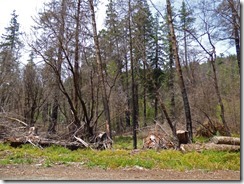
Evidence of the fire can be seen within 2 miles from the campground.  Here, if you look close, you can see a few trees with fire damage among an area of good healthy trees.  In fact, I can see fire damage on the hill from our campsite on the other side of the river. (no picture of that)

2017 Chetco Bar Fire

The firefighters, once called out, valiantly saved certain areas along the river, and Loeb State Park was definitely one of them.  In the Gardner Bar area there’s around 20 homes which were saved, but 3-4 up on the hill were lost.  I am sure it helped that there was a huge fire break between the small community and the mountain the fire came down…but still, firefighters had to work to save homes from burning ashes.
The fire burned six houses, forced 5,000 people to evacuate their homes and threaten communities from Brookings to Cave Junction..it cost over 60 million to fight.  The strategy by the Forest Service was to allow the fire to burn out.  Other fires in the past had done so.  This one probably would have…except for when the Chetco winds added a blast-furnace of 45 MPH to the flames…things got out of control very quickly.

747 Super Tanker

This is a 747 Super Tanker…it can carry 19,000 gallons of water - and dump it all as fast as 7 seconds … just a few drops from it back in early July, and there would not have been a story.  

At Loeb State Park we were filled to capacity Friday and Saturday, but at 6:30 Sunday there were still 10 sites open.  The past two years we were here it seemed that the park was full just about every night.  Hey, not complaining, the less campsites being used, the quieter the park is.

Sunday, July 29, 2018

Whiskeytown Lake – Carr Fire

At Sister’s House in Citrus Heights, CA

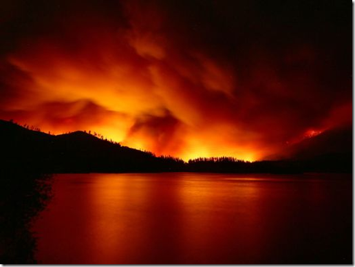
Whiskeytown Lake, Carr Fire, Redding, July 23, 2018 in Redding Record Searchlight

On Monday, July 23rd, a fire broke out at the Carr Powerhouse along highway 299 near Whiskeytown Lake, west of Redding California.  (NOTE: Judge Francis C. Carr (1875-1944) and his descendants played a prominent role in the development of the federal Central Valley Project, including Shasta Dam, and the creation of the Whiskeytown National Recreation Area.  The powerhouse was named after him.)  Above is a picture which ran Monday in the Redding Record Searchlight of the fire…and as you can see, there was a sailboat out in the lake just enjoying the day.  Monday night and Tuesday morning the fire was listed as being 2,500 acres, and 5-15% contained.

Whiskeytown Lake, June 13, 2018  Whiskeytown Lake, June 13, 2018

Above is what it looked like as we passed through the area on June 13th…such a pretty lake, and pretty area.

Whiskeytown Lake, Carr Fire, Redding, July 25, 2018 in Redding Record Searchlight

By Wednesday night the fire had more than tripled, and this is one of the last “good” pictures of Whiskeytown lake, again found in the Redding Record Searchlight

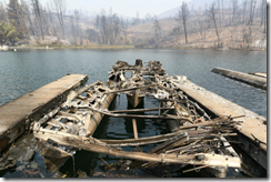
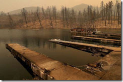
Whiskeytown Lake, Carr Fire, Redding, July 28, 2018 on Google Images     Whiskeytown Lake, Carr Fire, Redding, July 28, 2018 on Google Images

Today many news organizations are running pictures like these two above…Whiskeytown Lake has been devastated, the fire has reached Redding 14 miles to the east, and the fire, as of Saturday night, is listed at over 80,000 acres, there have been 5 deaths, and over 500 structures have been destroyed, with nearly 5,000 more being threatened, and over 30,000 people have been evacuated from Redding and the surrounding area. 

Fire Tornado, Carr Fire, Redding, July 27, 2018 by KPIX

With temperatures hitting 110, and winds blowing through the area, and with the fire itself creating its own tornado-like winds (as shown in this picture from a video on KPIX Channel 5)…this whole situation is out of hand.

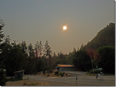
Huntley Park, August 22, 2017, solar eclipse and smoke from Chetco Bar Fire

Last year, the Chetco Bar Fire in Oregon (picture above taken on morning of solar eclipse shows the smoky affect in the area), which was caused by lightening, was allowed to burn for weeks, just a small little fire on July 12th, which grew into a 191,125 acre fire.  For weeks the forest service did little to try and put it out.  July 20th it was at 300 acres. August 2nd, up to 2,900 acres.  August 19th, it was over 22,000 acres, and by August 24th it was over 102,000 acres.  We learned of the fire while camping at Huntley Park around the 10th, and by the 22nd we evacuated the area and headed back to Sacramento.  Had they attacked the Chetco Bar Fire like they did the Lobster Creek Fire this year, no one would have even known of the Chetco Bar Fire.  Up in Redding, they did attack this fire, perhaps they could have been more aggressive at it, perhaps we need to be better prepared for something like this…but it is totally out of hand…and it isn’t going to be over for a long time.  Our thoughts and prayers are with the folks in and around Redding California, especially to those heroes that gave all, and to those who lost love ones.  Like Santa Rosa last year, it is going to be a long, hard fight to not only put out the fire, but to recovery from this terrible disaster.

Thursday, June 14, 2018

Chetco Bar Fire of 2017

At Alfred A. Loeb State Park

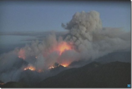
Chetco Fire, Picture by National Forest Service

Last year we stayed at Loeb State Park from July 24th through July 30th.  Little did we know that a MONSTER was in the woods not too far away, a small little fire which started by lightning on July 12th.  By the 15th it had burned 45 acres…by the 20th it had burned 300 acres, and there was no word about it in the news because of its isolated area, it would eventually burn out.  By August 2nd, while we were in Gold Beach just 28 miles north of Brookings, the fire started to worry the folks in charge, it was now 2,900 acres with a heat wave coming on.  By August 7th we were at Huntley Park just 7 miles east of Gold Beach for a two week stay.  By the time we left on the morning of the 22nd, Alfred Loeb State Park was shut down due to the fire, and the fire was heading north towards Gold Beach and Huntley Park.  We were going to go back to Loeb after leaving Huntley, but instead we left Oregon to get away from the fire.  THANK GOODNESS the fire never reached Loeb, Brookings, Huntley or Gold Beach…but it did damage over 191,000 acres!  Just think, one pass over with by a plane with fire retardant would have ended it on July 13th….


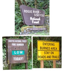
Signs for National Forest

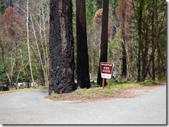
Wanting to see some of the fire area, I drove up the North Bank Chetco River Road beyond Loeb State Park where we are staying.  About 3 miles up you come to the National Forest Area sign, a “Low Fire Danger” sign for today (that’s good), and then the first sign of fire…a yellow warning sign announcing that you are entering a burned area, must stay on roads and trails.


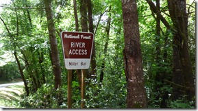
Miller Bar River Access   Miller Bar River Access

Miller Bar River Access

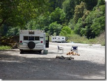
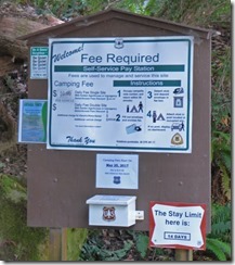
There are a number of National Forest River Access areas up here, the closest to Loeb is Miller Bar.  All of these have a camping fee of $10, $5 with senior pass, and for up to 14 days.  The only drawback…I had no phone and I am sure no Internet service at all.  Miller Bar only had two trailers today, and what looked like two or three tent campers.

Chetco Fire    Chetco Fire
Chetco Fire

Shortly after Miller Bar I could see a few signs of the fire.

Nook Bar River Access  Nook Bar River Access

At Nook Bar the fire had burnt the trees as you enter, and they obviously have a new sign up…but down by the river one could hardly tell there had been a fire.

Chetco River

And just a bit further along the road you can see some burned spots, and other nice pristine spots…it is a lovely river, that is for sure.

Redwood Bar River Access     Redwood Bar River Access, Chetco Fire

At Redwood Bar the devastation is much more intense.  A nearby National Forest Park Campground is shutdown, burned out with just a few picnic benches showing where camping spots once stood.  The funny thing…there were more people here, with a view of burned trees, than at the other two river spots.  Probably six trailers, a number of tents, and a number of day use folks.  Who would have imagined…

Redwood Bar River Access, Chetco Fire

Other than a splash of color, much of the area looks like the brown area in this shot above.  Like this and worse from here to 20 miles to the north…it was a devastating fire.

Alfred A Loeb State Park

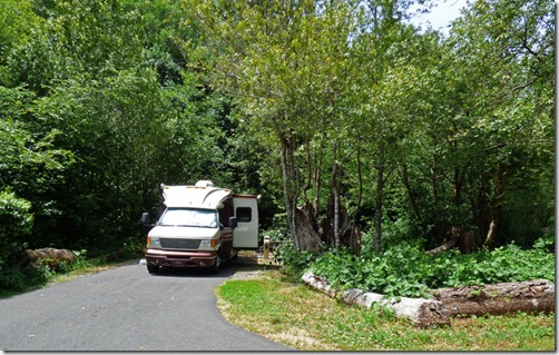
We left Keller Park at 8:15, went to the Brookings Rest Area north of town to empty our tanks, and arrived at Loeb State park by 10 am.  We could have got into the site we had last year, #9…but chose site #10 next to it instead.  We are level, no use of levelers at all, and have electricity and water.  Paid for 5 nights, but plan to stay for 12 and will pay the difference on Tuesday.  Price is $24 this year, up $2 from last year.  As of 4:00, there were only one or two sites still available…we had our pick of around a dozen sites.  Getting here around 10 or 11 is recommended if you want a site as there are no reservations here.  People who think they are going to get into Harris Beach State Park north of Brookings without a reservation seem to end up at Loeb…Harris does take reservations, and the sign along the highway said they were full.  So here we sit, temps around 75 degrees with a slight wind – just suffering our butts off….life is good.
Tuesday, August 22, 2017

A Different Look at Eclipse

From Huntley Park Oregon to McCloud California

Smoke in Medford Area from Chetco Bar Fire   Smoke in Medford Area from Chetco Bar Fire
Smoke in Medford Area from Chetco Bar Fire    Smoke in Medford Area from Chetco Bar Fire

Yes, this is taken on Eclipse Day…no, it is not the MOON blocking out the sun, it is the SMOKE.  We did watch the Eclipse from Huntley Park Oregon, then proceeded over to Myrtle Creek…then to Medford…then to Talent where we stayed the night in a Rest Area.  ALL of these pictures taken above were taken between Myrtle Creek and the California border yesterday and today.  The bottom right picture was taken as we were leaving Harry and David in Medford…about 6:45 pm.  NEVER seen the smoke so thick, and this smoke is being attributed to the fire near Brookings, called the Chetco Bar Fire.

Chetco Bar Fire

When you stay in an area for a month, and then a MAJOR fire takes place in that area, the connection you made sucks your emotions into what is going on.  You have met nice people in the past month…the hosts at Alfred Loeb State Park, the checkers at Fred Meyer in Brookings, or at McKay’s Market in Gold Beach, the workers at Indian Creek RV Park, the hosts at Huntley Park, and of course, D & D of Double D’s Cafe in Gold Beach and their entire family, most of whom we had the pleasure of meeting.  All of these people are being affected because they know people who have evacuated…and they probably know or know of the five families who have lost their homes so far…with many more threatened.  In the above map I have added, in RED, the various places we stayed at…along with the Fire Perimeter.  They listed the two levels of evacuations areas…level 2 is be prepared to leave, level 3 is get the heck out of there.

Oregon highway 42

It did not take us long on Oregon Highway 42 before we started to see the thick smoke.  We went north because they asked people not to drive down highway 101 toward Brookings…too much stuff going on down there.  By the time we got close to I-5, we could smell it.  We drove by On the River Golf & RV Park, a place we have stopped by many times before…they looked full to the brim, and the smoke was just too thick.  Didn’t even try our back-up plan in Myrtle Creek, Millsite RV Park, a city park, because the smoke was just too thick.  We went on to Medford to visit Harry and David…Sis LOVES Moose Munch, and since her and Arny both have birthdays next week, one day apart, we had to pick up “stuff”.  (I can see her licking her chops already…)  After the shopping spree, we headed to Talent where there was suppose to be a RV Resort through Passport America, which looked promising on paper…but it ended up being a HUGE DUMP…one of the worse we have seen…and it was also full…and we did not want to stay there even if they had sites open…yes, it was that bad.  And how do they even come to think they are a resort????  So we stayed at a Oregon Rest Area….along with many other people, most of whom were Californians headed back home after the full eclipse.

I-5 north of Medford, 5:30 pm Eclipse Day 2017

There was a wreck about 5 miles before Medford.  Marcia and I were counting the California plates as they went by us…4 out of 5 vehicles were California plates, with occasional Arizona and other states in the mix, and about 1 out of 5 were Oregon plates.  So it is safe to say…some Californian did something stupid and caused a wreck.  By the time we got up to it, an hour later, it was gone, so it is just a “educated guess”… 

McCloud RV Resort, McCloud CA

So this morning we had our coffee, a quick breakfast and off to McCloud California to one of our favorite RV parks in NorCal…McCloud RV Resort which we have been to 3 or 4 times now.  We DON’T like the prices necessarily, and they have some strict rules about their grass…which keeps the grass in such good condition I guess.  But it is not as hot as other Northern California areas, has lots of shade (although we lose our shade around 1 and it isn’t back until 5), and it is very peaceful.

McCloud RV Resort, McCloud CA

Of course, there are jerks who like to park their trucks on another person’s site…but I won’t go into that…nor the nine attempts to back into his site…yes NINE.   Now on the other side of his trailer he has three chairs, lots of other camping stuff, along with his park provided table…and there is room to back his truck up more, but heck…he would probably hit the fence or his awning, so it is much easier just using a chunk of our site.  And then there is the bigger jerk who let both his dogs off leash, and when I spotted them, I did not take Bubba or Skruffy their way...but they both made it over our way.  His Shepherd got a bit noisy, which then gets Skruffy going, and frankly, I was ready to give it a hit in the noise had it become aggressive.  The guy says, "Sorry, did not know it got out...", and just then the Shepherd comes running over.  I had seen them, and I knew he knew they were out, so I just said, "You know, that is why they make leashes."  He did not look at me, he just got his dogs and walked away.  GRRRR!!!

McCloud RV Resort, McCloud CA    McCloud RV Resort, McCloud CA
McCloud RV Resort, McCloud CA

But the park is just a lovely place, and we are here for two nights.  Yesterday’s drive was twice as long as it needed to be…it is only 120 miles from Huntley to the Rest Area…but that route is on a paved, National Forest road which is not recommended for RVs.  Had we gone through Crescent City, it would have been a 160 mile trip…but as it was, due to the fire, we drove over 240 miles.  And once we hit I-5, the traffic was a a crawl numerous times due to traffic and wrecks.  So two days to regain our sanity is in order…then we will head the 4+ hours back to my sister’s house…with a stop at a Truck/RV wash on the way back to Sacramento, one which we have used in the past…and after all the dust and dirt we accumulated these past seven weeks, it needs it.  As for us…the long showers we had this afternoon felt real nice…the 94 degree weather, well, that did not last very long.

2017 Eclipse

And YES, we did watch the eclipse, or at least I tried to get some pictures of it.  This is the best one I got, about 9:55 am, 20 minutes before our 95% coverage.  No matter what, the sun was too bright for the eyes, and our camera did not do so well capturing it.