
Friday evening I took Skruffy for a short drive up river to get another shot from the Bridge of the Chetco River. The lighting was different than last time, and the river was not moving much to the tides, offering a good reflection.

"What did you think of that little girl?"
"Dad, you KNOW I can’t see…why even ask that question??"
First time I had taken Skruffy on a little trip in awhile…she loves to go in the car, but she just can’t see that well anymore. I can NOW pull up next to another car with dogs inside of it, and she is oblivious to them. If it is not a bright sunny day she sees better…the darker it is, the more she sees especially if the target (ie: another dog) has some illumination to it. She will be outside in the shade with me here at the park, and she has seen people walking their dogs, and of course, Skruffy will be Skruffy and she will bark. If it is just people walking by (or kids on bikes or skateboards), she gives a small moan in anticipation of barking IF she sees a dog with them. But out on a walk in the sun, dogs have gotten very close to us and she smelled them, but otherwise did not know they were there.
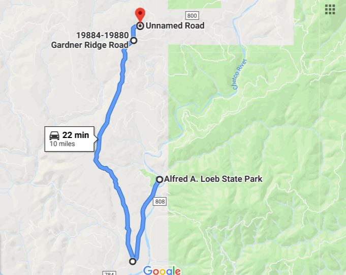
Yesterday, with all the action here at the park, I decided to go on another drive…this time I went back towards Brookings, and turned north on Gardner Ridge Road. I knew that Gardner Ridge would eventually lead back into another part of the Chetco Fire area, but I was hoping I might find a hill tall enough to see the ocean…but to no avail on that idea. After about 7 miles on Gardner Ridge Road, there is a dirt road off to the left, which I also took. Google Maps shows that dirt road ending fairly quickly, but I know I went up that dirt road about 3 miles before turning around. My guess is that after the fire the road has been added to, and probably connects to another dirt road that is also on Google Maps, all for the logging operation to rid the area of the burned trees.

After four or five miles on Gardner Ridge Road, which by-the-way was a lovely drive up to the ridge with a few scattered homes here and there, I started to see some of the devastation from the fire.

Eventually it was right up to the road, and went over the road…

…and off it went towards the Ocean -- over this ridge, down the next and onward. Thank goodness they stopped it before it took out the communities of Carpenterville and Pistol River, both of which did evacuate around August 20th because it looked like the fire wasn’t going to stop until it hit the ocean. As I said before, they did lose about 6 homes…a few of them were probably further down Gardner Ridge Road than I wanted to travel...but Google Maps shows some homes down that way, but they have not updated their maps since the fire.

Above is a wide-angle view of the area looking to the east, and you can clearly see where they (the fire fighters) stood their ground and stopped the fire from heading a more southwestern course towards Brookings. Had the fire been allowed to just burn, there is no doubt that Brookings and all the way up to Gold Beach would have been taken out.

Driving further down the dirt road, which was headed in a north-easterly direction from what I could tell, I saw this line of what looked to be lost crops (see arrow).

But they were not crops at all, they were burnt, downed trees that the loggers had put into these rows. (picture has been magnified and is not as crisp as I like).

As I continued down the dirt road, I came upon some more rows of these trees lined up right alongside the dirt road. The rows of downed trees continue right down the hill off from the road…but I did not feel adventurous enough to walk out there and take a picture looking down the slope.

Eventually I turned around on the dirt road and headed back. Here is a picture of Gardner Ridge, with the arrow pointing to the communication towers at the top of the ridge, and you can see the Gardner Ridge Road going through that green patch just off center in the picture. While on the dirt road, I did not see another car. While on Gardner Ridge Road, I passed a few cars going the other way...very light traffic indeed.
When I got back to the Chetco River Road, I turned right towards Brookings instead of left towards Loeb State Park because the dirt road took its toll on the HHR leaving it covered with dust. As I awaited my turn at the car wash, I texted Marcia to let her know where I was and that I would be running later than my 3 pm estimated time of return. One thing I did notice while driving the Gardner Ridge Road is there are at least two turnouts where we could park overnight “IF” we get shut out from getting back into Loeb State Park. On Tuesday we head north 30 miles to Gold Beach, but we plan to return back to Lobe four weeks later. That would give us another two weeks, taking us through the Labor Day Weekend before we start back to California. Lobe has been very busy so we "could" get shut out for a day, but I plan to be here early enough to make sure that does not happen…but if it does, we have a few alternatives, and Gardner Ridge Road is just one of them.
It's always so sad to see fire damage. Then again, I suppose fire is good to keep the brush down. Hopefully they won't have to worry for several years now. Such beautiful country!!
ReplyDeleteI just told Marcia last night that if anyone was thinking of moving into the area here, now is the time to do it because the threat of a large uncontrollable fire is going to be way down for many, many decades.
Delete