Showing posts with label Ridgway State Park. Show all posts

Monday, June 12, 2017

The True Grit of Ridgway

San Juan Mountains, Colorado
Cimarron Range of the San Juan Mountains, Colorado

Ridgway Colorado is nestled along these mountains…the San Juan Mountain Range has 14 of Colorado's 53 peaks which are over 14,000 feet in height, and Mt. Ridgway is at 13,468 feet.  The top picture is of the San Juan Mountains up by Ouray, perhaps the peak is Mt. Sneffels which is the highest point at 14,150 in the county of Ouray.  The river is the Uncompahgre River, which passes right through the town.  In the picture below is the Cimarron Range of the San Juan Mountains, with Uncompahgre Peak at 14,309 feet, which is the highest summit of the San Juan Mountains, the sixth highest summit of the Rocky Mountains of North America and of Colorado. and is located in the Uncompahgre Wilderness of Hinsdale County to the east of Ridgway.

Old Bank Building, Ridgway Colorado
The town has many older buildings, like this bank building to the left which is not shops…older because the the town was founded in 1890, and was the northern terminus of the Rio Grande Southern Railroad where it meets with Denver and Rio Grande Western Railroad running between Montrose and Ouray.  With the mining towns ofRidgway Community Church, Ridgway Colorado Telluride and Ouray nearby, and now with the ski resorts of Telluride, Silverton and Durango nearby, Ridgway has been uniquely placed where folks either drive to and stay, or drive through headed for these other nearby location.  There are the typical buildings one would find in a old town like this.  The “little white church” to the right sits right along its main thoroughfare.  This is the Fire House, Ridgway ColoradoRidgway Community Church now, I am fairly certain it had other names in the past.  And, of course, every good town needs to have a fire station (left) and a host of restaurants, liquor stores, gas stations, tourist shops featuring lots of items to buy, businesses which will taking you hiking, rafting, fishing, and wintertime activities of skiing and jet skis.  The town has a population of around 1,000 people, and it is not an inexpensive place to live…not with these views.

Buildings in True Grit, version 1969, Ridgway Colorado

And this corner…this one-way street, is the heart of the city for tourists.  Can you read the name of this store here on the left?  It may look a bit out of place…below it is enlarged so you can read it.

Fort Smith Saloon from True Gritt Movie 1969 version, Ridgway Colorado

Yes, that is right…the FORT SMITH SALOON!  Now WHY would the Fort Smith Saloon be located in Ridgway Colorado???  Because, when you look at the picture which features the saloon and adjoining buildings, it is where this happened…..

Just before Chaney Shoot Frank Ross, True Grit Scene, 1969 Version

Chaney Shoot Frank Ross, True Grit Scene, 1969 Version

This is where Tom Chaney shot poor Kim Darby’s father in the first release of the movie “True Grit”, 1969.
True Grit Restaurant, Ridgway Colorado

True Grit Restaurant, Ridgway Colorado   True Grit Restaurant, Ridgway Colorado

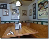
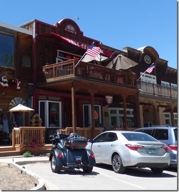
And one of those buildings along the street has been turned into the True Grit Cafe…and the food was pretty good.  It is two stories, but I did not climb the stairs, and other pictures I took did not turn out so well (should have handed the camera over to Marcia).  But it is full of True Grit and John Wayne memorabilia, and is the most popular restaurant in town.

Park of Hanging Scene, True Grit 1969 version shot in Ridgway Colorado

Across the street is a very large city park…this is where the….

Hanging Scene, True Grit 1969 version shot in Ridgway Colorado

…hanging of the four criminals took place.  Places in Ridgway, in Ouray, and in the surrounding area is full of shots from the movie.  If you want to see a good YouTube about the movie and various places, I suggest this one here. 

Dennis Weaver Park, Ridgway Colorado    Dennis Weaver Park, Ridgway Colorado

Saw a sign to Dennis Weaver Park, and pulled off the highway and drove a mile down to a nice 60 acre park built to honor Dennis Weaver.  Weaver, who was a star in the long running Gunsmoke and then his own show McCloud, along with numerous other roles, moved to Ridgway with his wife and was very active as a Environmentalist. The park runs along the Uncompahgre River and is a pride and joy to the people who live here, and who visit.

Deer, Ridgway State Park, Colorado

Pulling back into the park from our dinner we are greeted by four deer.  The weekend was a loud one with the park filling up, many young families, and today we saw the park loose 2/3rds or more of its population.  Not sure where the deer were over the weekend, but they came back Sunday as people left.  Tomorrow we too are hitting the road.  A quick stop in Montrose for our medicine from Walgreens, an oil change at Valvoline, and nails cut at PetCo, and off we go.  I “HOPE” we have Internet tomorrow…if not, you will need to wait a day. 

Friday, June 9, 2017

Making an 89 Mile Trip into a Full Day Travel Event, on to Ridgway State Park, Colorado

Sunset at Ridgway State Park, Colorado

One hundred and forty miles today…left around 9 am, got to Ridgway State Park around 1:30 pm.  No, we did not stop to rest, did two quick potty breaks of which the dogs got one of those breaks too…it was just a 140 miles of back road highways, slow travel to enjoy the beauty of it all.  Above is our sunset to the east…the sun is already blocked by the west.  Ridgway State Park is 20 miles south of Montrose, 15 miles north of Ouray, and minutes north of the town of Ridgway.  (And yes, to my kids, it is spelled without a “e” in it…unlike Ridgeway Road in Pine Bluff) 

Map as the crow flies vs our roads

Here is the distance “as the crow flies”, only 89 miles (shown with red line)…but our route, which is the fastest and shortest route, was 140 miles (shown in blue line).  ---Yes, there is a site "As The Crow Flies" Distance Calculator---  To get there we headed south for a mile on US 191, headed east-southeast on US 491, then headed north-northeast on Colorado 141, then southeast on Colorado 145, then northeast on Colorado 62, and finally north on US 550.  Had about 8 miles of 7 percent downhill grade along Colorado 141, all with no cell phone signal by-the-way, so no way to call for help if something goes wrong.  But it sure was a pretty drive…

heading east-southeast on US 491, Colorado Utah BorderDid not take long to get into Colorado from Monticello.  This part of the drive I have driven many times having driven from Arkansas to Utah, taking I-40, heading north at Albuquerque or at Gallup, and then into Southwest Colorado, and coming into Utah right there at Monticello.  But a few miles later we turn left on Colorado 141, and everything is new to me.


heading north-northeast on Colorado highway 141

The agricultural lands between Utah and Colorado quickly disappeared, and just before an area called Slick Rock, we had a good 8 miles down hill, dropping nearly 2,000 feet with lots of 7% grades.   Thankfully, little traffic either way, because I shifted down to first gear for a good mile of this as it winds left, right, left on steep turns.  Even in first gear I had to use the brakes to keep the RPMs under 3,000, which is the max I will run in first gear.

heading north-northeast on Colorado highway 141

As you near the bottom at Slick Rock we pick up the Dolores River for a few miles…the road runs just to the left of the river in the above picture.  What a gorgeous day we had.

heading north-northeast on Colorado highway 141
Then the highway heads due east for a number of miles, and then northeast until it intersects with highway 145.  We saw some cattle…even a number of newborns, a few horses, but no other wildlife.  Really thought we might catch a glimpse of Pronghorn, or some deer…but no luck today…just clear skies, and a few clouds that looked like angles.


heading southeast on Colorado highway 145    heading southeast on Colorado highway 145

We then turn onto highway 145, and the terrain again changes, and we come upon the San Miguel River which parallels the highway for a long time.  Marcia is hanging out her window, I have my right arm reached over holding onto her waste so she doesn’t fly out the motorhome, and finally tell her that a hundred pictures of a fricking river is more than enough!  (Well, a little bit overstated…but she did a great job getting all these pictures as I drive…and I did make a comment about “how many pictures of a river are enough” and later she replied, “I am not taking that picture because I have “ENOUGH” of the river…”, as a good picture passes us by…)

heading southeast on Colorado highway 145      4b

It was amazing to us that on Marcia’s side of the road, the rocks were red…while on my side they were more of a granite look…

heading southeast on Colorado highway 145 

Her side won the beauty contest, that is for sure….

heading northeast on Colorado highway 62

Our love of highway 145 ends as we turn onto highway 62 and highway 145 continues on through Telluride and eventually to an elevation of over 10,000 feet.  We have been on a constant slow climb for the past 40 miles or so, and as we turn onto highway 62, that climb intensifies a bit.  Marcia gets a few shots of the Sneffels , a sub-range of the San Juan Mountains…finally the Rocky Mountains are getting closer and closer.

heading northeast on Colorado highway 62, Dallas Divide

Down the road a bit there is a fairly large turnout, and I have not walked the dogs yet…so of course, we pull off.  There are no signs here, but we are actually at the highest road elevation of highway 62…at 8,983 feet, we have stopped at the Dallas Divide, a saddle between the San Juan Mountains to the south and the Uncompahgre Plateau to the north.  (View this 45 second YouTube video on how to pronounce Uncompahgre.  Undoubtedly the name will appear again and again in future blogs as there is a River, a Mountain, a Forest range, etc. which have this name.)  There at the turnout there was a young man who I saw pouring water into his radiator.  I pull up beside him and ask if he needs more water.  “That would be nice, do you have any?”  “Uhh….yes, this is a motorhome.”  I get out and open our entry door where we have a water outlet in the stepwell, ask Marcia to turn on the pump and fill up his gallon container.  He was so thankful…only has about 5 miles to get back to his campsite, so I am sure he is ok.

heading northeast on Colorado highway 62

Finally we are headed down to Ridgway…have a bit of a wait due to construction in town there, and soon after we are headed north on US 550, and four miles later we are pulling into Ridgway State Park.  We don’t have a reservation, but if you can find a spot, you can stay for two nights…if it does not show up in the reservation system the next morning, you can add a night, and you can keep doing that up to 14 nights total. 

Ridgway State Park, Colorado     Ridgway State Park, Colorado
Ridgway State Park, Colorado

The park is pretty nice, but don’t expect to hide under shade unless you get out and sit in chairs under a tree…but you might have to share the shade with strange neighbors who like to wander through the park eating grasses…(better than having strange neighbors going around smoking grass I guess...which is totally state legal here in Colorado, but not in the park.)

After getting camp set up, I head north to Montrose to turn in our drug reorder at Walgreens, and do some heavy duty shopping at Walmart (including getting Skruffy's insulin and needles).  On Monday we need to get the oil changed in the motorhome, and get Bubba's nails clipped at Petco, and I spot both of those places on the trip.  Back home at 6:30, exhausted after all that transpired, I start the blog, but only get 1/3 done before I just can't type anymore.


Sunset at Ridgway State Park, Colorado

And remember that sunset to the east I opened the blog with…well this was the view to west about 20 minutes later as I looked out the window from my recliner.  What a hard life we live…