Showing posts with label Lake Granby. Show all posts

Tuesday, September 4, 2018

Motorhome Makes it Over 11,000 Foot Pass

At Flagler Reservoir and State Wildlife Area, Flagler, CO

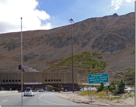
Eisenhower Tunnel, elevation 11,158, I-70, Colorado

Colorado has some high passes…some very high passes.  We had three choices before us…go through the National Park, which has an elevation of 12,183 feet, go through Berthoud Pass on US-40, which has an elevation of 11,307 feet, or head west on US-40, south on highway 9, and then travel east on I-70 with an elevation of 11,158 feet, and is 40+ miles longer than the Berthoud Pass route along US-40.  Going through the National Park was out immediately…going up 12,000 feet on a two lane road, and then going through Estes Park, Boulder, etc…just was not going to happen.  Going over Berthoud Pass, on a two lane road…well, it was doable, but just not the wise thing to do in my opinion.  So we took the longer route through Silverthorne, which is located where highway 9 and I-70 meet.  Once on I-70, we had 10 miles of incline…going as slow as 30 mph at times, but no real curves to negotiate, and three lanes of Interstate roadway.  Just put it in 2nd gear, and slowly made the climb up and up and up…and then into the Eisenhower Tunnel, where a slight decline starts, and then a near constant decline all the way into Denver.

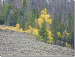
Fall has just started, Lake Granby, Colorado    Fall has just started, Lake Granby, Colorado

Fall was definitely arriving fast at Lake Granby.  On Monday we went into town to do a bit of grocery shopping to hold us over until we reach the Kansas City area, and we both noted the colors on the trees which we had not noticed when we arrived two weeks ago.  We had a few nights down in the 30s while we were there, and a month from now the highs will be in the 50’s, lows in the 20’s.  It was time to move on regardless…and Sunset Point will shut down before the end of the month, although a few of the parks do have a few camping spots available during the winter, mainly for the hard core hunters and fishing fanatics. 

Byers Canyon, Colorado

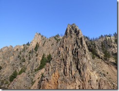
A small portion of today’s travel was along US-40, going over the same ground that we took to get to Lake Granby.  Just west of Hot Sulphur Springs, is Byers Canyon, a short gorge cut out by the Colorado River.  Told Marcia that when we left Lake Granby, she would be in a better position to take some pics…and she got some good ones. 

Byers Canyon, Colorado     Byers Canyon, Colorado
Byers Canyon, Colorado

The rock formations along the walls of the canyon are wonderful, now if only we could have had a train going along the tracks which run on the other side of the Colorado River from the roadway….

Colorado River emerging from Byers Canyon, Colorado

Goodbye US-40, and the great Colorado River.

Green Mountain Reservoir, Colorado

Between US-40 and I-70 along highway 9 is the Green Mountain Reservoir.  In previous posts about Lake Granby I mentioned the tunnel that takes water from the western slopes and moves it to the eastern slopes where 80% of Coloradans live.  Well, Green Mountain Reservoir was completed before all of the other reservoirs that help divert the water from the west to the east because environmentally minded folks wanted to be sure that the water was replaced that was taken away.  This time of year, the water level in the lake is very low due to this diversion.  It has a capacity of 153,000 acre feet.
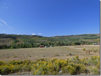

Highway 9 between Kremmling and Silverthorne Colorado   Highway 9 between Kremmling and Silverthorne Colorado

Going the route we did, we entered highway 9 at Kremmling Colorado, elevation of 7,300 feet…and exited onto I-70 at Silverthorne Colorado, elevation 9,000 feet.  In between, besides the Green Mountain Reservoir, is some fine ranch lands, and the highway department has provided large fences with crossovers above and below the highway for any wildlife that needs to cross.

Denver Colorado

Soon we were in Denver…

Headed east on I-70, Colorado

And once through Denver, and the lighter than expected traffic, and a quick stop for the dogs to use the plush green grass, something they had not seen for awhile, we were headed east along a fairly straight, fairly level I-70, and I finally was able to use cruise control.
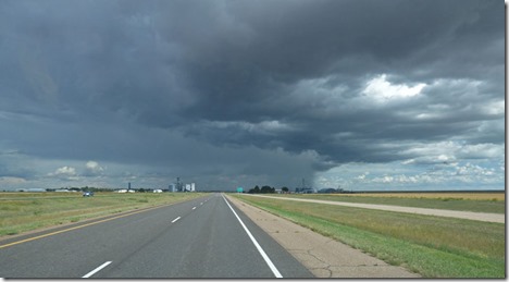
Storm to our east on I-70, Colorado

After another stop in Limon for gas and propane (those 30-40 degree nights tend to eat up the propane even when you have the thermometer set to 63 degrees), we got closer to our destination…Flagler Colorado.  Just a dozen miles away, and low and behold…a storm.  Thank goodness there was a rest area just down the road from when this picture was taken, where we sat out the storm for about an hour.

I-70 Diner, Flagler, Colorado   I-70 Diner, Flagler, Colorado

Weren’t we surprised to see a Pink Caddy up in the air at our exit…right in front of I-70 Diner, an old Kroll's Diner out of North Dakota.  The owner bought it, shipped it down on 6 semis, and after they acquired the land, had it open within two months.  600 people came to eat on opening day, July 4, 2007.

Flagler Reservoir State Wildlife Area, Colorado    Flagler Reservoir State Wildlife Area, , Colorado

I was looking for a place to stay near the border of Colorado and Kansas.  Came across Flagler State Recreation Area on Google Maps, and found that it’s real name is “Flagler Reservoir State Wildlife Area “, and one can camp here for free.  We took a chance, and no one else was around other than a car or two checking it out.  The lake is fairly dry this time of year, and we have seen nor heard from any animals (outside of Skruffy and Bubba).

Flagler Reservoir State Wildlife Area, Colorado

As dusk neared, this little trailer pulled by a car went around to the other side of the lake, then came back and parked way down from us.  Other than a farmer or two driving by, and a natural gas truck making a delivery, we have not seen anyone else.
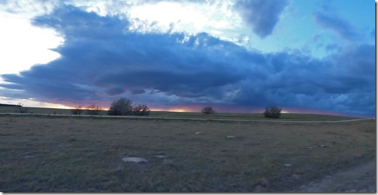
Sun setting west of Flagler, Colorado

A panoramic view of the sun going down behind another thunder storm.  We have not had rain as of 8:00 pm, although there was a storm warning about 20 east of us, but that expired.

Storm east of Flagler, Colorado

This is what it looked like to the east…warning said there was hail, and the storm was not moving…I guess it played itself out.  We have seen some flashes of thunder, but I think everything is settling down now.  Tomorrow we have our eyes set on a Cracker Barrel.  Sisters Sandy and Patti tried to take Mom and Dad out to the brand new Cracker Barrel in Sacramento for Sandy’s birthday last week…the wait was going to be at least 90 minutes so they went somewhere else.  I don’t think we will be having that problem…I am just hoping we get to stay the night.

Sunday, September 2, 2018

Camping Options Grand-Granby Lakes – Labor Day Weekend

At Sunset Point Campground, Lake Granby, Colorado

Lake Granby

We REALLY like camping in the Rockies.  Being so close to Denver (94 miles) and the surrounding large cities such as Boulder (100 miles), Fort Collins (100 miles), Aurora (110 miles), Greeley (110 miles), Loveland (90 miles)  and many others, making up most of the Front Range Urban Corridor, which has a total population of over 4 million people, so you HAVE to expect people around you, especially on holidays like Memorial Day, Labor Day, and 4th of July.  However, that said, it does not mean that you can’t minimize the number of people you are around.

Willow Creek   

I already wrote about Willow Creek above… and Stillwater Campground below in previous blog posts.

Stillwater Campground

Willow Creek was a nice, quiet, out-of-the way campground with a 2+ mile nice dirt road to drive on before reaching the lake and the campground.  A first-come, first camp area, it would work nicely to get away from the crowds, and still have Internet.  Of course, staying for 2 weeks, most would need to dump their tanks at least once…which means another trip down the dirt road.  Stillwater, well, it just does not have the “it” factor due to crowded area, few trees, but good views of the lake at many camping sites.

Arapaho Bay Campgrounds   Arapaho Bay Campgrounds
Arapaho Bay Campgrounds

Another option is one of the three campgrounds in the Arapaho Bay area, about 9 miles down a mostly good, but not always good, dirt road in the Arapaho Bay of Lake Granby. 


Arapaho Bay Campgrounds    Arapaho Bay Campgrounds

Driving over there today I found three parks, totally full, most of the spots are reservation spots, but there were also first-come, first-camp spots at all three campgrounds.  However, cell service was nearly non-existent, so I am fairly sure Internet service would be too.

Arapaho Bay      Arapaho Bay

But Arapaho Bay is one nice looking area, that is for sure…if you can take the “Yukon type of road” leading to the area.  (See "Skagway to Tok – Pretty, Bumpy, Amazing, Difficult" for definition of Yukon Road)

Monarch Lake

Monarch Lake     Monarch Lake

Monarch Lake     Monarch Lake

And each of these campgrounds are very close to Monarch Lake, a very pretty alpine lake that has a 4 mile trail around it…nope, I did not hike around the lake.  However, the view is stunning…the above pictures were taken around 11 in the morning.  Warning….the parking is real tough to get into…the 40 car parking lot was full (except for the one ADA spot thank goodness), and another 40+ cars were parked along the dirt road leading to the parking lot…two tenths of a mile from where we parked to the end of the last car parked along the road.  WOW!

Monarch Lake Area    Monarch Lake Area

One of the reasons, besides the lake, for the parking situation is that the trailhead serves as a major access portal for the Indian Peaks Wilderness.  Many people there were there to hike, not to just look at the lake.  If you are in the area, take the opportunity to drive the 9 miles down the dirt road to the Arapaho Bay area and visit Monarch Lake…it is an easy short walk to see the lake, depending upon where you have to park.  Winking smile

National Forest area, Stillwater Pass Area

There are other camping areas, along with a free area which is available in the  Stillwater Pass National Forest lands. 

How to get to National Forest area, Stillwater Pass Area      How to get to National Forest area, Stillwater Pass Area

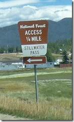
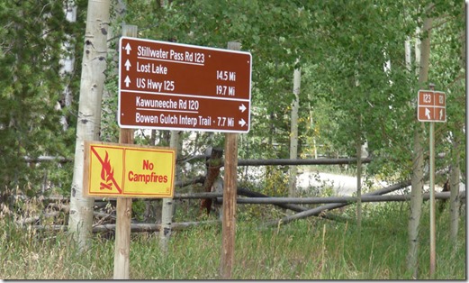
Heading to the National Park along highway 34, near the top of Lake Granby, just look for these signs above.  Once you turn on county road 4, it is about 2 miles of paved road before it becomes dirt…shortly after it becomes dirt road, you are on National Forest land, and there are numerous camping spots over the next 2 miles.

National Forest area, Stillwater Pass Area

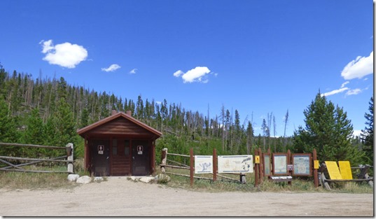
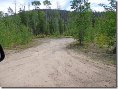
One area, about a mile in on the dirt road, is this large parking lot, with the bathrooms show a couple of pictures earlier located at it.  On this day, all I saw were pick-ups with trailers that they hauled their ATVs on.  Did not see an ATV, nor did I hear one…but the trucks are proof that they are around.

National Forest area, Stillwater Pass Area    National Forest area, Stillwater Pass Area 

National Forest area, Stillwater Pass Area

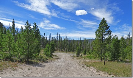
The first four or five camping areas were being used the other day when I wandered into the area, but these three, each of them past the large parking lot, were all available.  28 days of free camping, and the dirt road was in real good shape…way better than the dirt road leading to the Arapaho Bay area, and nearly as good as the one to Willow Creek.

National Forest area, Stillwater Pass Area

I only traveled a few miles up the dirt road…but the road continues for 20 miles, or you can take another side road for around 8 miles.  I am sure that there are many camping areas up along both areas.

Lake Granby

The Labor Day weekend sure brought out the boaters!  The boat launching ramp near our camping spot is filled to the brim…

Lake Granby

Sailboats, motorboats, fishing boats…lots of boats, but the lake is so large it does not look crowded.

Lake Granby

Just wish they had a restriction as to how close these personal water crafts can be to the campground….the buzz, buzzz, buzzzz is noticeable, especially after having so many days of peace and quiet here in the park.

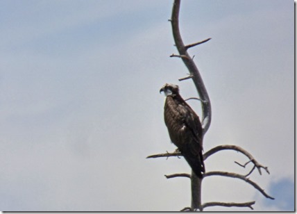
Osprey at Lake Granby

I think this guy is thinking about heading south early as he looks out over the waterways.

From Lake Granby looking toward Granby    Lake Granby 

Lake Granby

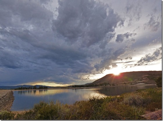
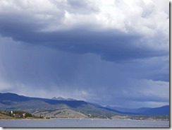
Although the daily afternoon storms, which can end up being just showers or hard, yet short lived, rain, drives folks off the lake, and it always makes for nice evening picture taking.  Lots of large groups of campers this weekend…but that won’t last long.  Tomorrow nearly everyone here will be leaving, replaced I am sure by others who are just passing through the area.  On Tuesday we will be headed out ourselves…thankful that we made it through another major holiday unscathed.