Showing posts with label Kings Canyon National Park. Show all posts

Saturday, May 12, 2018

Kings Canyon Scenic Drive

At Azalea Campground, Kings Canyon NP

South Fork Kings River, Sequoia National Forest, Kings Canyon Scenic View    South Fork Kings River, Sequoia National Forest, Kings Canyon Scenic ViewSouth Fork Kings River, Sequoia National Forest, Kings Canyon Scenic View

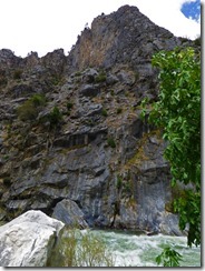
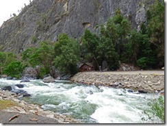
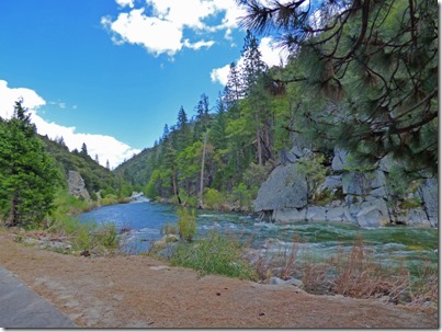
The story of Kings Canyon starts with a glacier and river which cut out the canyon.  As we passed along California Highway 180, we quickly left the small portion of Kings Canyon at Grants Grove and entered the Sequoia National Forest.  The road eventually winds down from over 6,000 feet to the 4,000 foot level.  The canyon walls close in on the highway, which runs along the Kings River.  The three shots above show the river in its fast, furious form…and then a much calmer form. 

Sequoia National Forest, Kings Canyon Scenic View

Here is a panoramic shot of us at the 6,000 foot level, the road winding down in the middle of the picture a thousand feet below.  The highway continues to the left of this picture, winds down the middle, then eventually cuts right into Kings Canyon just to the right of that largest mountain.  What a view!

Sequoia National Forest, Kings Canyon Scenic View

Now we are around the 5,000 foot level, and the road can be seen to the far right, still heading down.  In the middle of the picture is the middle fork of the Kings River, and at the bottom it is being joined with the south fork of the Kings River, which can barely be seen just below the road.
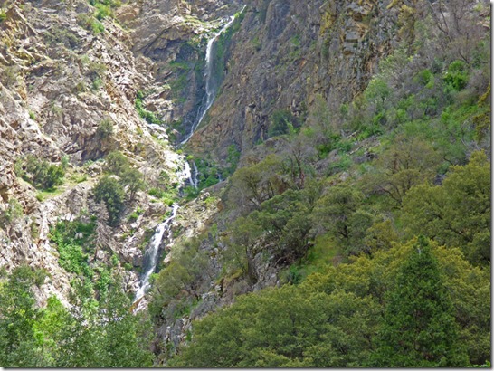
Redwood Creek, Sequoia National Forest, Kings Canyon Scenic View

Further down the road, and just before entering Kings Canyon, we see this waterfalls which dries up in another month or two, and I could not find a name for it, but it is part of Redwood Creek.
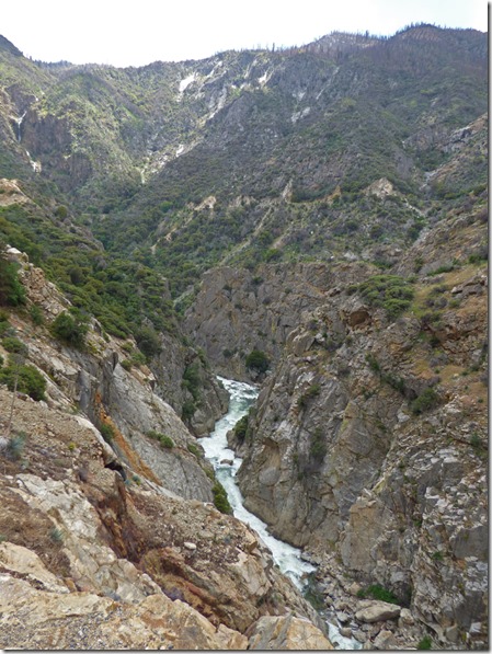
South Fork Kings River, Sequoia National Forest, Kings Canyon Scenic View

Now we have entered Kings Canyon…not the National Park, just the entrance to the canyon…we have another 9 miles before we re-enter the park in the main area of the park (not just the Grant Grove area where we are camping).  In the picture above, if you click on it and look closely at the larger picture that comes up, the water fall the picture above is in the upper left corner of this picture.
 
Sequoia National Forest, Kings Canyon Scenic View     Sequoia National Forest, Kings Canyon Scenic View
Sequoia National Forest, Kings Canyon Scenic View    Sequoia National Forest, Kings Canyon Scenic View

For the next 8 miles we were just in awe…the canyons, the fast running water…the first three pictures of this blog were taken in this area too.  And then we came upon the best waterfall of the day….Grizzly Falls, which, with a “s” on the end means that it is a cascading falls.

Grizzly Falls, Sequoia National Forest, Kings Canyon Scenic View
This is the view of Grizzly Falls from when I got out of the car.  Although the path to a better view of the falls is somewhat ADA accessible, Marcia did not want to walk it, and she did not want me to get the GoGo out since she had such a good view from the car.
Grizzly Falls, Sequoia National Forest, Kings Canyon Scenic View
And it was probably good she stayed, because the last 30 feet to get a good view was not ADA at all, as you can see as this man walks two kids back down hand in hand avoiding all the rocks.

Grizzly Falls, Sequoia National Forest, Kings Canyon Scenic View

A little patience to wait until everyone gets out of my view finally pays off with a good shot of the falls.  However, the mist did put some water on the lens, which you can see in the upper right and upper left of the picture where little circles seem to appear in the trees.

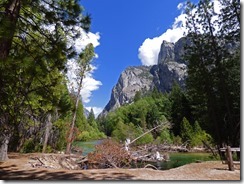
Cedar Grove area, Kings Canyon National Park     Cedar Grove area, Kings Canyon National Park

We got to the main portion of Kings Canyon National Park, and frankly, it was a little of a letdown after all the views we had in Sequoia National Forest along Highway 180, Kings Canyon Scenic Byway, to get to this point.  That is not saying we did not like Kings Canyon National Park…but getting there was better than being there.

Cedar Grove area, Kings Canyon National Park     Cedar Grove area, Kings Canyon National Park
Cedar Grove area, Kings Canyon National Park

This main portion of Kings Canyon, Cedar Grove area, has four campgrounds, Sheep Creek, Sentinel, Canyon View, and Moraine.  Only one was open today, but all will be open by Memorial Day.  Three take reservations.  So combined with the area of Kings Canyon that we are in at Grant Grove, there are eight campgrounds for RVs within the National Park…all costing $18 per day, $9 with the senior discount card, and you can put it on credit card.  There are dump stations in each area, but non open this time of year.  It is a 34 mile drive from Grant Grove to the end of the road at Copper Creek Trailhead.  The speed limit is 35 mph most of the way, 25 in a few small places.  It took us three hours to make the round trip, and that was after going to the Panoramic View near Grant Village, which is a one-lane road which climbs about 1,000 feet, with a half mile round trip hike to the point.
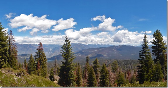
Panoramic Viewpoint, near Grant Grove, Kings Canyon National Park

This is the panoramic view…which is of some of the area we traveled today.  It is a nice view…but the drive is well worth the time.

Friday, May 11, 2018

General Grant Grove

At Azalea Campground, Kings Canyon NP

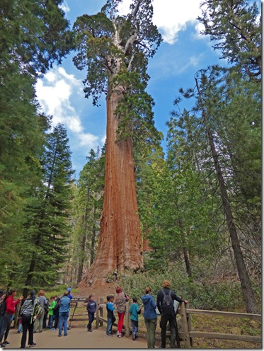
General Grant Sequoia Tree, Grant Grove

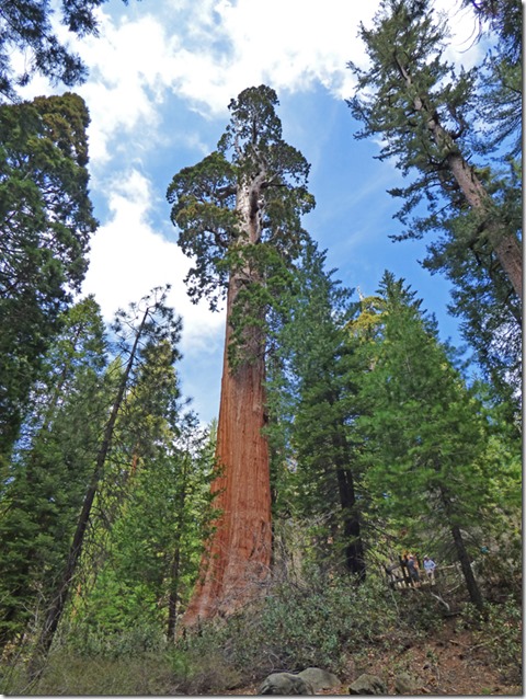
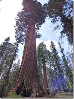
The General Grant Tree, above, is the second largest tree known to man, behind the General Sherman Tree which is in Sequoia National Park.  There is a difference between “Tallest Tree” and “Largest Tree”.  The General Grant Tree is only 267 feet tall…the tallest tree, named Hyperion and is located in Redwood National Park in Northwestern California, is 380 feet tall.  But when you take the width and height of a tree you can figure out how much cubic feet of wood are in the tree.  The Grant Tree has a Circumference of 107 feet, and contains 46,608 cubic feet of wood.  Hyperion, though taller, only contains 18,600 cubic feet of wood. 

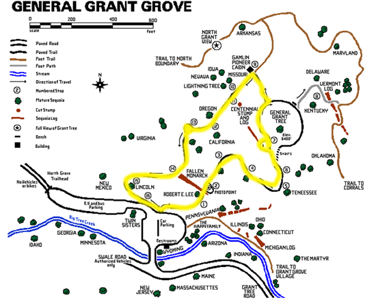
Map of Grant Grove, Kings Canyon NP

The General Grant Tree is located in General Grant Grove…which once was once called General Grant National Park, before it was merged into what is now Kings Canyon National Park.  The Grove stands alone as a separate portion of the park, separated by Sequoia National Park and Sequoia National Forest.  Both the parks are jointly administered by the National Park Service as the Sequoia and Kings Canyon National Parks.  The Grove is very close to the Azalea Campground, where we are staying, and the Sunset and Crystal Springs Campgrounds which open in the next couple of weeks. The main trail, which is highlighted in yellow, is very ADA friendly, and Marcia had no problems with her GoGo except for the fact the battery was a bit low, and I helped to slightly push her for about 20’, although it may have made it on its own.  That path was about 1/2 of a mile, no more than 3/4 of a mile.

Robert E Lee Sequoia Tree, Grant Grove    Fallen Monarch Sequoia Tree, Grant Grove

There ae many interesting trees in the Grove, including this one to the left, the Robert E. Lee Tree, which looks like it is standing on its toes, and the Fallen Monarch where I got a picture of two people inside of this fallen tree which has showed very little decay in over 100 years, and was used for shelter back in the late 1800’s.  The Lee tree is the second largest in Grant Grove, and the eleventh largest giant sequoia in the world.

General Grant Sequoia Tree, Grant Grove

Above is another view of the Grant Tree…note the two people to the right, how they look like ants compared to the magnitude of this tree.

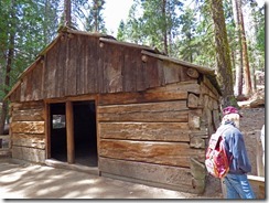
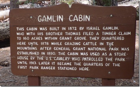
Gamlin Cabin, Centennial Stump, Grant Grove     Gamlin Cabin, Centennial Stump, Grant Grove
Gamlin Cabin, Centennial Stump, Grant Grove

The Gamlin brothers lived in the “Fallen Monarch” while building their cabin.  The cabin have been moved and reconstructed three times after it was first built, with improvements of a concrete foundation in 1978 and lower walls of sugar pine replaced with more insect resistant redwood, along with some of the siding.

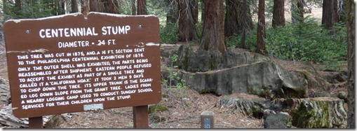
Centennial Stump, cut down Sequoia Tree, Grant Grove    Centennial Stump, cut down Sequoia Tree, Grant Grove
Centennial Stump, cut down Sequoia Tree, Grant Grove

Back in the latter half of the 1800’s, stories of these huge trees were being told, but folks just could not believe it.  So a few large trees were cut down, as was the tree from this stump above in 1875, and a 16 foot section sent to the Philadelphia Centennial Exhibition of 1876…and people still called it a “California Hoax”.

A Sequoia Tree, Grant Grove    A Sequoia Tree, Grant Grove
A Sequoia Tree, Grant Grove

Although these Redwood Trees are a bit easier to take a photo of than the Coastal Redwoods, it is still hard to catch the fullness of some of the trees.  The bottom picture above was taken in panoramic mode, and I still did not get the top of the tree.

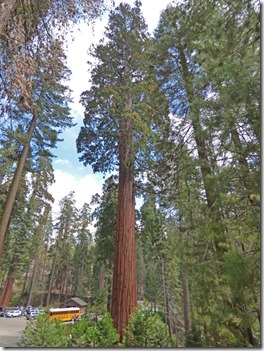
Lincoln Sequoia Tree, Grant Grove     New Mexico Sequoia Tree, Grant Grove

These last two trees are the “Lincoln Tree” to the left, and the “New Mexico Tree” to the right.  Look at the size of that school bus in the distance to the size of the tree!

Overall it was a nice easy hike (despite the 6,000+ feet in altitude), not too crowded, lots of folks from all over the world.  The time to visit is definitely spring, although portions of the Azalea Campground are open year around…spring is cool (it will be 38 degrees tonight, and only 57 tomorrow which is our coldest day) which is better than the extreme highs of 90+ in the summer.  In the winter, one can find snow easily at the 6,000 foot elevation level…but for the extreme campers, it must be a pretty sight to see…but many parts of the parks will be closed for the winter, but they try to keep the main highways open all year, except during and immediately after strong storms.  Tomorrow…we go for a drive….

Wednesday, May 9, 2018

Azalea Campground, Kings Canyon NP

At Azalea Campground, Kings Canyon NP

Our Site,  Azalea Campground

We left Mariposa Fairgrounds around 10 am, went to Madera for gas and Walmart, and then drove through Fresno and up highway 180 to Azalea Campground, in Kings Canyon National Park, and got setup.  By 4 pm, 7 pm Florida time, we were ready to watch Wednesday night church…just to find out that they had a sound problem…we could see, could not hear a thing, and we don’t read lips.  Oh well, saved a bit of aircard time.  (wink)

Our Site,  Azalea Campground     Our Site,  Azalea Campground

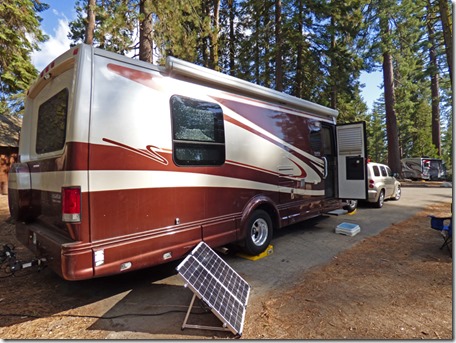
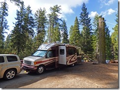
We picked the only ADA camping site in all of Azalea Campground…over 100 camping sites and only ONE ADA site, shame on you Kings Canyon National Park!  And the only thing I can see as to why this is an ADA site is because it is close to one of the restrooms…the pad is no wider or longer than others.  It is a bit more level…but even the leveling could use some help.  As for length…we just get the RV in and the HHR into the site…just barely.

Our Site,  Azalea Campground

We are without any hookups…there is water that we could fill our water tank if needed, but no dump station around that I know of…and no electricity, so out came the solar panel (picture one).  Of course, getting a lot of sunshine through these trees is going to be a task…perhaps 6 hours of good sun is my guess.  They do allow generators for just a few hours in the morning, and few at night.

 Azalea Campground    Azalea Campground

Took a drive through the campground, and found it to be about 2/3 full.  Some site are deep, like the upper left picture, and most are very slanted, like the upper right picture.  It is the only campground open in this area, but others will be open by the 21st of May.  This is always a first come, first served campgrounds, while others do take reservations.  We will be here for 5 nights, cost a total of $45 with the senior pass for National Parks. 

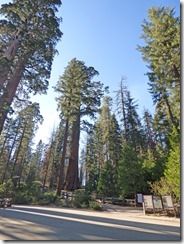
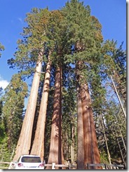
Sequoias in Grant Grove  Sequoias in Grant Grove  Sequoias in Grant Grove

Sure are some pretty trees around here…somewhere in there is suppose to be the General Grant Tree…it is just 1/2 mile down the road.  We will probably have that, and other pictures of these giant Sequoias in our next blog.