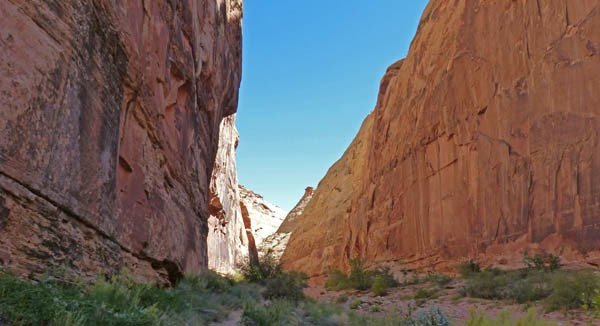
Capitol Reef is another wonderful place that is full of Interesting White and Red Rock Mountains, Cliffs, Gorges and Canyons, of lush green in some areas, and barren desert in others, a place where one can see so much right from the front seat (or standing outside) of your car, or even more interesting places through solitude hikes. September is one of Capitol’s busiest times…yet the crowds are nothing compared to places like Yellowstone, Yosemite, Zion and other popular National Parks during their busy seasons. I have never started a blog with so many pictures…but I could think of no other way of presenting a few of the 500+ pictures we took today.
There are many areas to pull over and survey the landscape…some with 360 degree views.
There is a visitor’s center, a museum, orchards where fruit is free for the picking and eating, or slight charge if you take it home.
There is a nicely paved road which is called the “scenic drive”, which is separate from highway 24 which runs east and west through the park. The scenic drive runs north and south, and covers about 10 miles before it turns into a dirt road which continues south and eventually west. On the east side of the park there is another paved road which travels some 16 miles or so before it turns into a dirt road, and eventually into the Burr Trail (dirt road portion). There are many dirt roads which connect with this main north/south road, and literally covers more of the park than any other paved road. The northern section of the park is not very accessible, and you need four-wheel drive for the much of the dirt road part.
We took two of the more popular dirt roads….this one to the Grand Wash parking lot…
…and this one to Capitol Gorge.
I opted to do a portion of the Capitol Gorge hike while Marcia and the dogs awaited in the car. I was intrigued by the promise of “Petroglyphs” and “Names carved in the rock of early Utah pioneers with dates as early as the early 1870’s.” “I won’t be long Marica….”, my famous last words. I had read that it was an easy hike…and it was….but I missed the part of it being 2 miles round trip….put that together with picture taking and I was gone 45 minutes or more. On my way back I hear, “Are you Dave?” “Yes,” I said, “I know I am in trouble….”. “Oh, I think she is just a bit worried is all,” she replies. GULP!
Here is the best Petroglyph I was able to capture…
…this was the older dates that I could find, 1883.
This “wagon trail” was smooth is some places, and very rocky in others. Don’t know how they got the wagons over the rocks….I figure they had to move them out of the way.
Out in the orchards we saw three deer on the way out from the scenic drive.
We all enjoyed our quick trip into Capitol Reef National Park. The dogs only had one remark about it…”Why do the stupid deers get green grass and we gets this red pebble crap?
I had read a little about the Burr Trail drive, did not expect it to be as wonderful and beautiful as it was. The “plus” is that it is way way more than just a drive through a magnificent canyon….it is a drive along a sandstone “turtle shell” mesa area for 9 miles, then down into the canyon and another 10 miles through the canyon, followed by another 12 miles through mostly open land with views of circle mesas, Capital Reef, Henry Mountains until the pavement ends as you enter Capital Reef National Park. Now the Burr Trail continues on for another 35 miles of gravel road all the way down to Bullfrog in Glen Canyon….but we only did the paved road because you can encounter washboard/washed out areas along the dirt road. (remember, if you click on a picture it will get bigger)

We had to drive the 30 miles to Boulder from Escalante Utah. As the crow flies, Boulder is only 20 miles north east of Escalante….but here you have to go with the flow of the land. The view above is due east looking over the North Eastern portion of the Grand Staircase-Escalante National Monument. From here scenic Highway 12 snakes down to that land below and starts to head northeast.
Had a comment from a follower that they think Utah Highway 12 is the most scenic highway. As we were traveling down the highway today I said to Marcia, “How does one compare this to lets say California Highway 1 from San Francisco to Santa Barbara, or the Going to the Sun Road in Glacier National Park, or other highways? They are ALL so wonderful, beautiful drives….” We had no answer other than this Highway 12 is among the best.
The turtle shell mesa area is fascinating. So named because of the pattern in the rock.
Suddenly the white rock blends with red, and then we have red rocks for the next 12 miles or so.
And suddenly we get the first look at the canyon that we soon descend down and into.
Here we just came down to the bottom of the canyon and start entering the ever so enclosing walls.
Marcia is having fun trying to capture the soaring walls full of their colors, their shapes, and of course, the trees which seem to grow right out of crevices.
There is a slot canyon at the 12 mile point in the drive….that is where we were parked in the opening picture of this posting. Above left you can see the entrance, above right is a shot looking back out of the slot canyon, and the bottom picture above is looking straight up when you get to the end. Due to the terrain, Marcia stayed in the car, but it is a short walk, and a wonderful place…wish I had it to myself, but there was only one couple in there with me.
The canyon by far is our favorite part of the drive. Marcia had me take the arch in the upper left picture above, while she took the other arch to the right, and the bottom picture above she found a “hole” at the top where the blue sky just barely peeks through.
As the canyon walls start to get wider, we come upon the Burr Trail Totems and Toadstools area.
We were amazed at how some of the totems, which are all red rock, have this solitary whitish rock sitting on top of it. Apparently the whitish rocks fall off the cliffs from above and sometimes they just bounce and land on top of the totem.
We exit the canyon and head further to the east. We have another 12 miles to go before we turn around, and a few times I nearly turned around early because it is now past 1:00 pm, and we have not had breakfast or lunch. Those are the Henry Mountains off in the far distance.
There are a few of these circle cliffs that we pass by as we travel through the flat lands of Burr Trail.
We finally hit the dirt road, and drive down it for a third of a mile just to get a few pictures, including the lower part of Capitol Reef on the left, and Henry Mountains on the right with Capitol Reef in the foreground. Once you hit the dirt road, you are in the National Park.
As we head back toward the canyon I stop and get this panoramic view. All the way to the canyon I try to spot the opening…you have to wonder how explorers found these canyons so many years ago on horse back of hiking.

We get a ton of pictures on the way home too. We did turn up the dirt road called Hells Backbone, but it is getting late, and we did stop for a late lunch at the Burr Trail Grill, which was good. We decided to have Hells Backbone wait until another visit. Hells Backbone is the first road to Boulder Utah from Escalante. You can’t do everything, and this will give us another reason, as if we need one, to return to the area. By-the-way, Burr Trail is named after stockman John Atlantic Burr who, in the late 1800's, blazed the trail to move cattle from the area around Boulder, Utah to the ford across the Colorado River at Hall's Crossing. Today it is a National Scenic Backway, and something you don’t want to miss if you are in the area. Not good for RVs they say, yet we saw a truck pulling a 25’ – 28’ trailer from the canyon out as we were entering the canyon. And there is a campground before the canyon which says it can handle 20’ vehicles.