Showing posts with label Bear River Casino Loleta CA. Show all posts

Sunday, June 14, 2026

The Big Escape


Heading into the Redwoods, Northern Cal

Yes, we have temporarily left the Sacramento area.  We are currently at Huntley Park, Gold Beach Oregon...one of our favorite places to just kickback and camp, enjoying the peacefulness and friendly atmosphere that we enjoy here.  Thursday we left the upcoming 100 degree weather, drove to Bear River Casino near Eureka where we stayed the night, and continued on to Huntley Park Friday.  We will be here until Monday when we continue up the coast.  

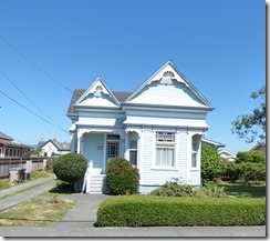
Ferndale is known as the "Victorian Village" because its entire downtown resides on the National Register of Historic Places.  

It has been a comfortable ride.  Drove through the Clear Lake area, through the Redwoods, and a side trip to Ferndale, a quaint little town near the Bear River Casino.  Got gas at the Casino gas station paying $5.65 a gallon, way less than the $6+ offered at regular stations.

Bear River Casino

The Bear River Casino Resort is owned and operated by the Bear River Band of the Rohnerville Rancheria.The Bear River Band is a federally recognized Native American tribe composed primarily of Mattole, Bear River, and Wiyot people.


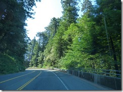
Friday we enjoyed a nice drive along the Newton B Drury - Redwood Scenic Parkway, in the Redwood National and State Parks.  Traffic along Highway 101 was not too bad, a few ongoing construction zones, but no long waits.  In Brookings Oregon we stopped at Fred Meyers for some gas, low $5 range, and groceries. 

Camp at Huntley Park

Arriving at Huntley Park around 2 pm, we were greeted by the park manager Shawn, who after 6 years still remembers us.  We have not moved the van since parking.  The only slight downside was needing the generator running to operate our AC yesterday for 3-4 hours due to the 90 degree weather.  FYI: when we first started coming to Huntley Park in 2017.  In 2019 we were going to be here for most of the summer...but Dad went into the hospital, then rehab.  He survived that scare, but not the one in November...we all sure miss him.  Then COVID hit, and as the years went by, we just never made it back to Huntley Park until this year.  Part of me wants to stay the remaining 3 weeks of our planned trip sitting right here...but there are other places we want to return to...and one new National Park to visit...so tomorrow we will continue up the coast.

One of my favorite Cooper Pics from Nancy's Blog

 Our hearts go out to our blogging friend Nancy who lost her BEST BUDDY Cooper to heart failure a couple days ago.  We know how hard it is to lose a dog, especially a great companion that Cooper was.  So sorry for your loss...and your hurting Nancy  Read her blog about Cooper HERE:   

 []

We also heard a couple of weeks ago that Gerry, Marcia's oldest friends, passed away with Gerry's daughter Ruth holding her in bed.  A quick and peaceful passing, but it leaves a huge hole in Marcia's heart.  We just saw Gerry back on March 29th.  You can read about that visit HERE:    Above is one of my favorite pictures of Marcia and Gerry, taken back in January of 2016, Amelia Island, Florida.  YES, that is Skruffy on Marcia's lap.


Wednesday, July 18, 2018

Bear River Casino for a ‘One-Night’ Stop

At Bear River Casino near Fortuna, California

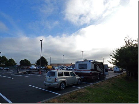
Bear River Casino blacktop camping, near Fortuna, Ca

Last year we stayed at the Bear River Casino for two or three nights.  All it takes it a FREE Bear River Casino Club Card, and then registering at the valet office, which seems to double as an outside security patrol’s office too.  Since I had the card, it only took a few minutes, and they give you a paper to put up on your window.  We are parked in the same location we parked last year…only this year the entire parking lot is being repaved…and they did the upper area, where RVs and large Trucks are suppose to park, first.

Bear River Casino blacktop camping, near Fortuna, Ca

We were the third RV to arrive, now there are five…far fewer than the eleven we had last year, but it is only 8 pm, so there is still time.

Bear River Casino blacktop camping, near Fortuna, Ca

It has been very sunny up until 7 pm…I took this shot just after putting the solar away, back under the bed where we store it when it won’t be used for a long time.  I figure it will be there for a month or more.  Tomorrow we will be in the Ukiah Fairgrounds, $37 with electric, water, and if we are lucky, sewer…if not, then use of the dump station.  Friday we arrive in the Occidental area where my son Michael and wife to be Anna will be married on Saturday…we will be there through Monday night, and arrive back in Sacramento on Tuesday.

Highway 101 south of Crescent City   Highway 101 south of Crescent City

The 100 mile ride from Crescent City changed from sun to ocean mist over and over again.  Every view of the Ocean looked like….

Pacific Ocean along highway 101 south of Crescent City

…this…misty, clouds, fog combination.  The drive is full of 30 mph to 55 mph (65 if you are not towing), and there were three construction spots which required us to stop, although one started up just as we arrived.  Traffic was light to moderate, and surprising, only a handful of bicyclist today.  With all the ups, downs, turns…one had to stay alert, so it is not an easy drive, glad it was only 100 miles today. 

Trees at Bear River Casino near Fortuna

Tomorrow will be closer to 150 miles…right through some very tall Redwoods.  Won’t see very much of the ocean anymore, sure like the looks of these trees along the coast, sculptured by the Ocean winds.

Sunday, July 16, 2017

Lost Coast Headlands -- Fleener Creek Overlook

Fleener Creek Overlook

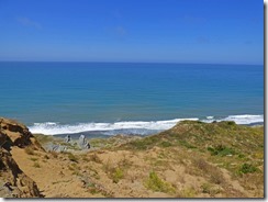
After a very restful night at the Bear Valley Casino, we awoke to early clearing skies, and by noon we were sitting in a overlook, overlooking the great Pacific Ocean (after filling up with gas and taking care of the waste tanks).  The Fleener Creek Overlook is a sparsely used Overlook with beach access (not ADA access though) about 4 miles west of Ferndale, Ca.  The area has a beach, which is large and also not very crowded, and it is less than 12 miles from the casino, and about a mile south of Centerville County Park, which is shown on Google Maps.  (if you click link to the park you can see the where it is).

Fleener Creek Overlook

This is a panoramic view of the overlook…you can see our lone motorhome over by the telephone/electric wires tower (left middle of picture).  For much of our three hours, it was like this…but at times we had cars (no other RVs) which parked.  Some people walked down to the beach, which meant they were going to be there for at least 30 minutes, while others stayed for 5 to 20 minutes before leaving.  Fleener Creek OverlookSome had dogs, some were old, some were young.   And for those who like to boondock in odd or desolate places…there are no signs that say no camping, and this overlook is on BLM land and is joint effort of the BLM, State of California, Coastal Conservancy, and The Conservation Fund.  BLM has authority and control, but gives the Coastal Conservancy much input and power too. 

Farm near Fleener Creek Overlook

If you look closely at the first picture in this post, you can see a small farm.  Picture above is what it looks like up close.  They have a small herd of cows, and they located the house just behind a small hill to protect it from fierce winds that might come off the ocean during storms.  Not sure how safe they will be if there was a tsunami, but it is a great location otherwise.

Fleener Creek Overlook    Fleener Creek Overlook
Fleener Creek Overlook

This area of the Pacific Coast is at the very northern edge of what they call, “The Lost Coast”.  When California Highway 1 was created, they decided it was too costly to put the highway along the coast any further north than just above Rockport, so they turned east and stopped the highway at Leggett where it connects to US Highway 101.  From Rockport through to the Eureka area, the coastal area is very isolated, mostly natural and development-free.  King RangeShelter Cove, with a population of around 700 people, is at the southern end of the Lost Coast…I have a niece who happens to live there.  At the northern end is Fortuna, Eureka and Ferndale, with some very small, isolated little communities in between.  There are many little coves and beaches along the Lost Cost, and most of it is Federal Land.  The King Range National Conservation Area is the largest portion of these lands.  Above it is the Lost Coast Headlands…and this overlook is at the upper north section of the headlands.

Fleener Creek Overlook

I did a short walk…not down to the beach, but just down the trail a small bit, and then off to a side trail which heads to this large concrete platform.  Down below the platform is this formation…which is man made, but has been destroyed.  I did some research and found that in this area, and the Centerville Beach (pictures will follow later in this post) was the site of a Navy Base back in the 50’s. 

Centerville Beach Naval FacilityNaval Facility Centerville Beach was commissioned on 25 March 1958. From the original compliment of ninety-five personnel and sixteen buildings, it grew to 280 personnel and twenty-four major structures. The facility was located approximately 260 miles north of San Francisco and 100 miles south of the Oregon border. It was situated on thirty-seven acres of rolling pasture land on a 320 foot cliff overlooking the Eel River Valley to the North and bordered by the Pacific Ocean to the West. In addition to its operational responsibilities, NAVFAC Centerville Beach also marked the location of the Readiness Training Facility from 1978 to 1985. After weathering three earthquakes in 1992, NAVFAC Centerville Beach was re-terminated at NOPF Whidbey Island and decommissioned 30 September 1993 after nearly thirty-five years of dedicated service.  (Quoted from www.public.navy.mil)

Centervile Beach County Park

Above is a picture of Centerville Beach County Park, free access to the ocean and huge beach with few people there.  Much easier to get to than the beach at the overlook a mile south…but at the overlook you can have a beach all to yourself…where here you have to put up with more cars, more people, and what looks like a mile of beach.  Yes, you can drive along the beach…not in a motorhome, but with certain trucks and 4 wheel drives.  This was right between low and high tide, and during some high tides, the road gets wet, especially around the corner on the far right of the picture.

Eel Bridge
Eel Bridge    Eel Bridge

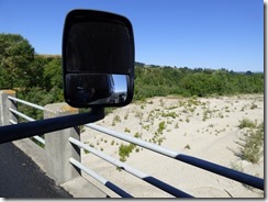
To get to the Centerville Beach County Park and the Fleener Creek Overlook, you have to pass through the town of Ferndale.  To get to Ferndale, you have to go over the Eel River…a fairly narrow two lane bridge.  For the most part, our right side mirror would be higher than the side rail…but there are about six taller concrete areas which would take the mirror out if I got too close.  As cars passed going the other way, they were close to my driver mirror.  I just went slow, about 20 mph, and we made it just fine.  As you get close to the Centerville Beach area, the road is in bad shape…a storm this past winter literally covered the roadway and they had to use heavy equipment to clear the sand and silt off the roadway, and they made some repairs to the road, but not enough.  We both had visions of being in the upper Yukon again from last summer…


Ferndale from Wikipedia

This picture of downtown Ferndale is from Wikipedia.  The town of Ferndale is just under 1,400 inhabitants, and contains dozen of Victorian style homes and storefronts.  Settled by white settlers in 1852, the area needed to be cleared of huge ferns, hence the name of the town.  Today the local economy is a mixture of dairies and ranching, agricultural support, retail and services.  The pictures below are of just a few homes that we took as we passed through.

Between beach and Ferndale, Ca     Between beach and Ferndale, Ca

These two homes above are between the beach and Ferndale.

Ferndale, Ca    Ferndale, Ca

We saw some even pretty homes…but they were on side streets and we were ready to get back to the Casino.  This time we parked further in the back at the casino, and had an even quieter night than the first night.  Today the fog/overcast is lasting a bit longer, but we will drive through Fortuna to view their Victorian homes.  It is Rodeo time for Fortuna, and we ran into a few barricades yesterday getting gas and dumping tanks (shell station in front of Safeway - free, but we needed gas too) for what I assume was a Rodeo Parade…hence the need to go today instead.  So far, we seem to enjoy sight seeing in our motorhome.

Friday, July 14, 2017

Bear River Casino, Loleta, CA

https://upload.wikimedia.org/wikipedia/commons/8/84/Loleta_CA_Bear_River_Casino.jpg

Had a good night sleep in Red Bluff, despite the heat. Turned off the A/C at 11:30 and climbed into bed…did not even hear Marcia when she came to bed just a little later.  Left at 9:00 am, but ran into a minor problem…for some reason the TV antenna did not go down in the proper position, and rattled something fierce as we started to depart the park.  Took me a bit to realize what it was, then when I tried to raise it so that I could position it right, the handle pops off and the handle, positioner and spring land on top of the slide out, which was, of course, “in” for travel.  Then, as I tried to crank the antenna up, I break the handle.  (This is like the fifth or sixth time I have broken a cheap plastic handle since 1986 when I first started living in a 5th wheel!)  Anyway, by 10 am we were rolling out of Red Bluff.

Map Red Bluff to Fortuna

I had decided to give California highway 36 a shot…not pulling the HHR, it seemed like it would be a nice scenic route.  Scenic it was…nice for 90% of it, but it was very hard near the Humboldt/Trinity County line…at times it was barely better than a one lane road.  But that only lasted about five or six miles…and there were three or four sections which had road work being done, with about 5 minute wait at one area until the escort truck arrived and took us along the road for about three miles.

We were going to stay at the Swimmers Campground at the Van Duzen County Park, along the Van Duzen river…but there was no Internet, so we drove on.  My back up plan was where we are, the Bear River Casino just outside of Fortuna in Loleta.  I had to get a player’s card in order to register…but there is no cost to stay up to three nights..and they put $10 on the player's card to entice you to gamble.  We were the first RV to arrive, at 3:30 pm, but now there are about ten RVs in the parking lot.  We can come and go as we wish, and tomorrow we will probably drive over to the ocean, about ten miles away, and find a place to stop and enjoy…after the morning fog burns off.  By the way…when we arrived at the Safeway in Fortuna it was a blistering 72 degrees.  Winking smile