Thursday, October 16, 2025

New Grandbaby -- It's a Boy, a BIG BOY


My oldest son Michael and his wife Anna, who are the parents of my lovely Granddaughter Addie, are now the parents of their second child, a boy.  Meet....Otis Boaz, born this morning at 3:35 am California time.  He came into this world weighing in at 9 lbs 9 oz ... but still shy of my record of 11 lbs, 11 oz ... but he is healthy, I was not.  

I was an RH Factor Baby before they had the medical knowledge on how to control that situation.  I am positive, mom is negative, so her antibodies attacked my Red Blood Cells.  Bottom line, the good Doctor cut me out, removed mom's Uterus, and that was that.  Except she was able to go home, I had to stay in the hospital for over a month, but made it home for Christmas. 

In this case, mother Anna and Baby Otis are both doing very well.  And despite the size of this child compared to Addie who came in around 7 lbs, the delivery was much easier this time...Anna had a very hard delivery with Addie.

I had the privilege of telling my mom about her new Great Grandchild.  In a text with my sisters I commented that when they go over to see her, she may not remember that I talked with her and that the new baby was born.  My sister Sandy said, "Good news is we can tell her over and over and over again and it will be as if it was the first time!"  That girl can sure come up with some funny, and in this case true, lines now and then...

On a VERY SAD note, my Aunt Florence (In the above picture, she is seated to the far left, next to Marcia, and then my Mother) died last Friday, October 10th.  She was 80 years old.  Her and LeRoy, "Uncle Red" to all of us (my father's brother), were married for 42 years before he died...which is how old Uncle Red was when they got married...she was 22, he was 42.  He had four kids when Aunt Myrtle died of Cancer, Flo had three kids from a not so healthy marriage.  Couple years after they were married, Baby Lee came along, and the rest was history.  Aunt Flo became a school teacher...not just any school teacher, but one who taught the special ed students...the hardcore students in many cases.  She was a wonderful Mother, Teacher, and Aunt..she will be dearly missed.  

I was surprised this morning that the NATIONAL HURRICANE CENTER and
CENTRAL PACIFIC HURRICANE CENTER showed absolutely no weather situations as of this morning.  October is Florida's busy time for bad weather...but not this year.  This evening they show possible, very low risk storms which might form in the next 7 days, but even these don't seem to be a threat to Florida or anywhere else in the nation.  The poor Weather Casters are besides themselves...nothing to report on.  Most the storms that came off of Africa ended up turning north into the open ocean...but on the radio I would hear this:

A tropical disturbance has formed off the coast of Africa and it has a 50% chance of becoming a Tropical Storm and perhaps a Hurricane.  If it develops into a tropical storm as we think it will, it will be called [insert name...the last one was Tropical Storm Lorenzo, which developed on the 13th, and was dead by the end of the 15th].   Then comes their disclaimer...Meteorologist say that this storm will turn north into the Atlantic and won't be threat to U.S. or any Islands.

Soon, Hurricane Season will be over...and so far, no Hurricane has hit the U.S., which is good news for all.

Monday, September 29, 2025

Humberto and Imelda Part Two


Normally if we see this picture above in Florida, we are emptying the stores of milk, bread, produce, meat, water, beer/wine/liquor, etc.  So this is the picture on NOAA's site and there is no talk, no panic, no nothing around here.  As I mentioned in my last post 2 days ago, the forecast was/is for it all to turn out into the Atlantic and go away.


Above is Imelda, now a Tropical storm, but soon to be a Hurricane.  You can see the right hand turn that it is going to take, according to all predictions.  In my last post, the right hand turn was going to take place much closer to the South Carolina Coast...but now it turns tomorrow, just about the same Latitude that Orlando has.  (Latitude is "east to west" while Longitude is "north to south").  


Good news, very little affect on Florida other than some rain and higher waves on the Atlantic Coast.  Above is a radar view as of 6:30 Monday Night.  Damage from Imelda to the Bahamas included flooding, power outages, and coastal storm surges, particularly affecting the northwestern and central islands.

Above is the forecast for Humberto.  It looks as "IF" Imelda and Humberto might link together as they head out to the Atlantic, but this is just a "Hopeful Scenario" on part of some Meteorologist.  Speaking of which...

Do any of you ever have the impression that some of the Weather Reporters find some sort of "Glee" when they talk about Hurricanes, Tornadoes, Snow Storms that drop more than 6" on a large metropolitan city except for Denver or Salt Lake City (and a few others) where these snow storms are common???  Last night Marcia and I watched FOX Weather Channel for about 30 minutes to hear about the latest dealing with the Weather.  We had heard about flooding in Arizona, and wondered where it was.  Nearly ALL of the 30 minutes that we watched was reporting on Humberto and Imelda.  We did not even hear about the Arizona flooding, which took place in communities of Globe and Miami in Gila County.  What we did hear was the reporter talking with "Glee" about these two storms, how much they were going to grow, how much "danger" there will be along the coast of Florida and perhaps the Carolinas, and how it looked like the two storms "might" combine into one horrific storm, yet the future models he showed had no indications of them merging.  But phrases such as; "These are just beautiful storms here, especially Humberto which the radar shows to be a perfect Hurricane." and "Doesn't this just look lovely..."  and  a few other phrases which put the importance and focus on the GREATNESS of these storms, and not how dangerous the storms are, how dangerous they will be "IF" they don't turn east and head out to the open Ocean (right over the Bermuda).  He did pull up a live stream camera of the Bahamas, but it was nothing more than normal summer rain storm here in Florida!  One can almost hear the desperation in his voice trying to make these storms into the BIG STORMS that they love to report on. 


Saturday, September 27, 2025

Humberto and Imelda

 Ok, a little premature to call it Imelda just yet, but the current Tropical Depression will be Tropical Storm Imelda real soon...while Humberto is already a Hurricane.  Let's look back a week to see how we got to where we are now...


 On Saturday the 20th of September Hurricane Gabrielle was still a Tropical Storm, and a new yellow disturbance had just come off of Africa.  Hurricane Gabriella was headed north, and then East, so it was not a concern to us.


The very next day (Sunday) the yellow area turned to Orange, another yellow area developed to the west of the orange disturbance, and Gabrielle was now a Hurricane, but moving north with a forecast of moving North-East.


 The very next day (Monday), the Orange turned to Red, and the Yellow turned to Orange.  Now this has my attention...

Fast forward to today, we have lost Gabrielle, which died off in the cold waters of the Atlantic.  Humberto, which was a Tropical Storm yesterday, is now a Hurricane.  The other disturbance is now Tropical Depression Nine, soon to be Tropical Storm Imelda, and soon after that, Hurricane Imelda.  Now, let's see just where these two storms are headed...


Humberto is forecast to head North-West, turn, and head up into the Atlantic where it will die in a few days.  The only land mass which will be highly impacted is Bermuda.


The future Imelda is more problematic.  Anytime I see a Hurricane's forecast to head straight for land, and then abruptly take a right hand turn...that is definitely one to watch.  If that turn does not take place, South and North Carolina are in for a direct hit.  As it goes along the coast of Florida, it is going to cause flooding, rip-tides, and probably a few tornadoes.  Good news for now, no developments in the Gulf, the Caribbean, and nothing more off Africa.  Imelda id going to be the major concern for now...not for us in the Tampa Area, but for the East Coast and many of the Islands along its path.


Wednesday, September 17, 2025

Tropical Storm Gabrielle and More


As predicted, the newly formed Tropical Storm "GABRIELLE" has turned north/northwest, and looks like our country is free from harm. Let me explain the image above...  The "Green Circles" are the past path of what is now Gabrielle, formerly known at AL92 (explained in previous blog).  So, we dodged THAT bullet...

But...and with Hurricane Season, there is ALWAYS a "but"... There are two more possible disturbances behind Gabrielle.  I have NEVER seen two yellow areas on top of each other.  These are TWO different disturbances.  The one with the Yellow X is off the coast of Africa, and it is too early to know if the conditions are going to allow it to grow.  The second, larger yellow area is still located on Africa, and seems to be a bit larger of a storm, and it might have a larger chance of growing.
 

Above is an image of the computer spaghetti models.  The legend in the above image has all sorts of colors and initials...these are the names of the computer models that developed them.  For instance, "CMC", the light blue line, is the Canadian Meteorological Centre, the Canadian government agency that produces a global weather forecast model. AVNO was an older name for the current American Global Forecast System (GFS), a primary numerical weather prediction model run by the National Weather Service (NWS) and its parent organization, the National Oceanic and Atmospheric Administration (NOAA).  If you are interested more, I will let you do the research on the other model names.  There are over 15 different computer models...the one I choose only has eight models listed.  Below is one that has what seems to be 30+ models...and this was before it was a tropical storm, and they all show a trend northward, away from the USA.


Lastly, one needs to have a good local meteorologist they can rely on.  Mine is Paul Dellegatto. Paul Dellegatto is the chief meteorologist for Tampa's FOX 13 (WTVT). He is a highly experienced meteorologist specializing in severe and tropical weather. He has been with WTVT since 1990 and became chief meteorologist in 1997.  He has monitored and reported on numerous storms, Tropical Storms, and Hurricanes.  Below is his latest tweet about Gabrielle from Paul.

So, in short, this is how we get through Hurricane Season.  When it starts looking bad, we will get in the van and leave, driving as far away as needed to get away from danger, and get away from a no electricity scenario.  Will try to keep you all updated on how things are going...


Monday, September 15, 2025

Hurricane Season at HIGH ALERT Next 6-8 Weeks


Five days ago, this is what the 7 day forecast looked like...nothing for the next seven days.  This site is the National Hurricane Center Website, maintained by NOAA, which is the National Oceanic and Atmospheric Administration. (https://www.nhc.noaa.gov/) It is the "go to" website that I monitor from mid-May through mid-November.  However, September and October are the months when Florida Hurricanes are most likely going to develop.  Lots of storms show up on the NOAA site, some don't materialize, while others grow into Tropical Storms, and then Hurricanes.  Around September 1st we had the same scenario that we face now (as presented below), and then it all just fell apart.  Well...this is where we are now.

September 10th, later in the day from the first image.  NOAA was warning about possible formation in the next 7 days at 20% chance.  On that date, the storm was still on land in Africa.
 
Two days later, the storm has moved off of Africa and into the ocean (orange X), it now had a 40% chance of forming in the next seven days.

Three days later, which is today (Monday), the storm has moved further into the ocean, and the potential is now up to 90% in the next seven days.
 
Above is the two day forecast which includes satellite view...you can clearly see the potential of the future Tropical Storm Gabrielle, and most likely future Hurricane Gabrielle.  Now they call it "Invest AL92".  The name "Invest AL92" comes from the "Invest" designation, short for investigative area, used by the National Hurricane Center.  AL means it is in the Atlantic.  The number "92" is simply the 92nd investigation of the season, a sequential number assigned to the disturbances.

One thing I like about this NOAA website is they provide a short synopsis of the storm.  Once it becomes a Tropical Storm, most likely in the next day or two, you can even get a storm path forecast line within the red cone.  In the next few days I turn to other websites which show "Spaghetti paths".  These are predicted paths formed by various "Weather Gurus".  Will let you all know how things look in the next few days.  Even "if" this turns into a Hurricane, and "if" it heads for Florida, most likely it will hit the Atlantic side, and not the Gulf side where we live.  "IF" that happens, it will take a 8-10 days to get near us...the Camper Van will be full of gas, just in case.


Wednesday, July 30, 2025

Colorado National Monument - Rim Rock Drive


We have been home since Sunday afternoon.  Camper Van emptied, Marcia got the laundry done (I do laundry on the road, she does it at Condo), and Camper Van is in the RV Storage next door with Cameras active, auto generator setup (although with all this sunshine, it won't be needed until later in the Winter), and when it cools down, I will give it a good cleaning inside and out.

But back 10 days ago we were in Fruita Colorado, and while waiting for Marcia's prescription to be ready, we took the Colorado National Monument - Rim Rock Drive.  I had known about this scenic drive for many decades, but never took the time to drive it.  With a free Sunday, awaiting her pills from Walgreens on Monday, off we went.  Not only did we drive it from Fruita to Grand Junction, we then turned around (after locating Walgreens) and drove it back to Fruita.


 Both of the above pictures look down on Fruita...Grand Junction would be to the far right.


Established as Colorado National Monument in 1911, there have been some efforts to turn it into a National Park.   Wikipedia says it best:  "Sheer-walled canyons cut deep into sandstone and granite–gneiss–schist rock formations. This is an area of desert land high on the Colorado Plateau, with pinyon and juniper forests on the plateau."


The views along the road and the numerous pullouts is amazing.  There are many hiking trails, but with the summer heat, we did not see people taking hikes.


There are three tunnels on Rim Rock Road.  If you are in a high vehicle, the center provides 16' of clearance...but the sides only provide 10' 6".  There is a campground with 79 sites, with water and bathrooms available.  Cost is $22, or $11 with the National Park Senior Pass.


 We were lucky enough to see two Bighorn Sheep.


Rim Rock Road is about 30 miles in length.  Figure it will take you 90 minutes to drive the route.  It took us half that long when we did our return trip.  Cost is $25, or if you have a senior pass, it is free.

Wednesday, July 23, 2025

Upper Colorado River Scenic Byway


As I write this blog entry, it is Wednesday evening, we are in Alma, Arkansas, just outside of Fort Smith, and plan to meet up with Marcia's cousin Jim tomorrow for breakfast...he lives in Fort Smith.  After that, we are headed to Pine Bluff to visit one of my fellow Library workers, and then on to Florida.

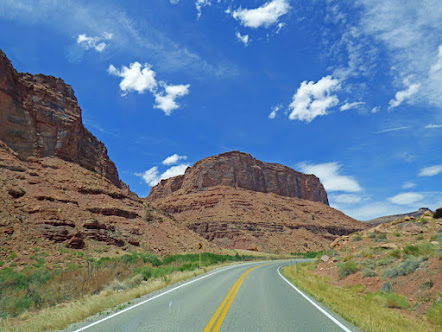
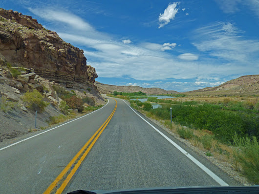
This entry, however, deals with the Upper Colorado River Scenic Byway, a route we took earlier in the week while still in Moab.   The Upper Colorado River Scenic Byway is a 44.5 mile route which follows the Colorado River along a canyon.  We entered the Byway just north of Moab as it starts where Highway 191 crosses the Colorado River.  Most people don't take the time to travel the Byway...what a mistake that is.  It ends at the Ghost Town of Cisco, close to I-70.  We made the mistake to follow our GPS to the east at Cisco, which takes you on a very rough 8 miles until it reaches I-70.  Taking a left headed west takes you 2 miles on a smooth road, and easy access to I-70.  Either way, once on I-70 it is only an hours ride to Grand Junction, or 20 minute ride back to Highway 191.


There's about a dozen BLM Campgrounds along the Byway, most of them along the first five miles.  There's no water, no electricity, some have outhouses, and there is little to no Cell Service along the entire route.


The hardest thing about the drive is keeping your eye on the roadway...it is truly a stunning view.


 There are many areas along the river that rafters/boaters float west along the current.


The canyon widens and narrows back up.  At its widest point, I did get a little cell phone service, but it was spotty (both Verizon and T-Mobile)  The only way I would camp in the area is if I had a Starlink connection!
 

Eventually you cross the Colorado, and a few miles down the road the colorado turns to the southeast, and the road turns to the northeast.  The last couple of miles is just Utah desert, and then you come to the Ghost Town of Cisco...where there is one "store" (if you can call it that) which is open that sells beer and soft drinks...not sure what else, we did not stop.
 
We turned to the east and found a nice Rest Area/Welcome Center in Fruita.  Marcia had a prescription which needed filling, and although we ordered it Thursday morning, it was not ready until Monday.  So we found another scenic route to take while in Fruita...one that I had my eye one since the 1980's....  That will be our next posting.