Sunday, August 26, 2018

Lake Granby Weekend

At Sunset Point Campground, Lake Granby, CO

Lake Granby

Lake Granby   Lake Granby

Having driven through Rocky Mountain National Park, I knew that we did not want to stay over in the Estes Park area…’WAY’ too many people.  Thought about trying to get into the Timber Creek Campground, which is inside the National Park…but when I saw all the various camping options between the cities of Granby and Grand Lakes, with three large lakes, Lake Granby, Shadow Mountain and Grand Lake…well, I decided to look into this area a bit closer. 

Stillwater Campground, Lake Granby

The Stillwater Campground, as seen Saturday late afternoon above from across the lake from us, is the biggest campground, mostly through reservations, but with a handful of first come-first camp situations.  I am sure this campground was much more appealing when it had more trees…which were removed years ago due to the Pine Beatle infestation.  I am sure most campsites have a view of the lake now…but they also have a view of just about every other campsite in the campground. 

Sunset Point Campground, Lake Granby

When I saw that Sunset Point Campground was all first come-first camp type of park, that appealed to me.  When I saw that the campground still had trees, that appealed to me.  When I saw that it is laid out along the lake, all on one road (no loops) along the lakeside, that appealed to me.  Now, as a first come-first camp park, you have to have a plan…our plan was to arrive on Tuesday around 11 am…that worked real good.  We immediately met camp host Suzzie and her friend Elaine who were riding a golf cart up and down the road.  Suzzie, who works along with her husband Rick, rattled of a list of campsites which were available…and suggested campsite #12.  We got down to 12, and yep, did not need to go further.  As we were setting up, she comes by and hands us a pay slip, says she will be back through later to pick it up…cool.  Later, when talking to Rick, I found out they have worked here for 8 years straight now…come up from Fort Worth each year.  The picture above is what we see right outside our entry door…and the park is full.

Sunset Point Campground, Lake Granby

Yesterday late afternoon, soaking up theSunset Point Campground, Lake Granby 78 degree weather, I sat at the rear of the motorhome in the shade and took this picture above of a gal walking her dog.  Look at how hard it is to see her and the dog, yet they are right in the middle of the picture.  The picture to the right is a close up of them.  There are lots of dogs here this weekend, and keeping them all on leashes has been a slight issue until Rick catches them and says, “only one more warning, after that you and the dog are out of here!”  But the point I want to make is that with all the trees, yes, our view of the lake is impaired a bit…so is the view and noise of the neighbors…especially distant neighbors.  And the nights have been so quiet, especially after 10 pm when generators have to be off.  Honestly, I have heard a few generators, but nothing that caused us any grief. 

Bubba and Skruffy at Sunset Point Campground, Lake Granby     Bubba and Skruffy at Sunset Point Campground, Lake Granby

With no campers behind us, it is where I normally walk the dogs…away from the street and away from the view of other dogs.  Had a Long Haired Dachshund, who was being walked on a leash, get away from its owner as it was being put into their motorhome…and it rushed over to say hello to Skruffy and Bubba.  Bubba just stares and wags his tail, Skruffy and the other Dachshund have to bark at each other to let each other know that they are related…honestly, their barks was like listening to a stereo of Dachshunds barking.

Osprey Nest near Lake Granby     Osprey Nest near Lake Granby

Have not seen any wildlife on this end of the lake, but I did find two Osprey nest nearby.  The one on the left is further away from us, but right alongside the road…the one on the right is closer to our location, but much further away from the road, but down an embankment so you can see more of the nest.  I have seen these birds flying through the park, but with the trees, they suddenly appear, and then they are gone, headed to or from the lake.

Colorado River below the Lake Granby Dam

As I drove over the dam yesterday, I got this shot of the Colorado River.  They won’t let you stop on the dam at all…safety issue they say from 9-11 attacks.  The Colorado looks so small…

Near the headwaters of the Colorado River, Rocky Mountain National Park

…but this picture above was taken of the Colorado up in the National Park.  The headwaters of the Colorado are up in the park, and to see those headwaters, one has to hike about 10 miles along the river.  This picture was taken just a mile from the Visitor’s Center.  Now that the weekend is over, we plan to head back up into the park…probably Tuesday since Monday is going to be laundry day.  Today we will just sit back and enjoy the departure of about 1/3 of the parks occupants, and the rush of newcomers looking for a spot for a day or two.

Friday, August 24, 2018

Rocky Mountain National Park -- Trail Ridge Road and Old Fall River Road

At Sunset Point Campground, Lake Granby, CO

Rocky Mountain National Park, western portion Trail Ridge Road

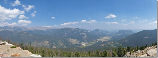
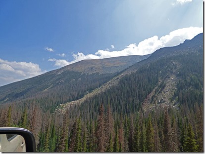
One thing we found about being up in the high Rockies…it still is not high enough to get away from the smoke from California, Oregon, Utah and Colorado fires.  Still, the views were just amazing.  (of course, the locals blame it all on Cal fires)

Elk, Rocky Mountain National Park, western portion Trail Ridge Road

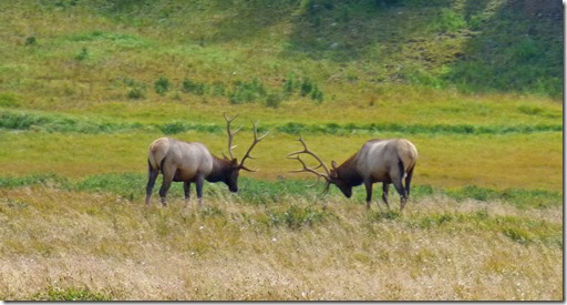
We saw many Elk on our drive, but these ones here were the closest…

Elk, Rocky Mountain National Park, western portion Trail Ridge Road

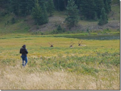
And of course, despite signs, and even the presence of three rangers in the area, some folks just have to get out and try to get close…amazing.

Rocky Mountain National Park, western portion Trail Ridge Road

This view is still of the western slope, and you can see the smoke hiding the mountain afar.  The Rockies are the Continental Divide, separating where rainfall and snow melt will flow…either to the west to the Pacific, or to the east to the Atlantic through the Gulf of Mexico.

Rocky Mountain National Park, eastern portion Trail Ridge Road   Rocky Mountain National Park, eastern portion Trail Ridge Road
Rocky Mountain National Park, eastern portion Trail Ridge Road

These are views along the eastern slope…that smoke just won’t let up, even with the 30-40 mph wind gusts.

Rocky Mountain National Park, Alpine Visitor's Center, Trail Ridge Road

At the Alpine Visitor’s Center, what I call “Heart Attack Hill” was full of those sucking in the 12,000 foot air as they climbed up the Alpine Ridge Trail.  The hike is only .6 of a mile, but it is steep, does not include oxygen, and with the wind…well, it was hard enough just getting Marcia into the Visitor’s Center, let alone having me even attempt this trail.  The parking lot was pretty full, but we scored with an ADA spot right at the door…and yes, Marcia said, “I am staying in the car next time” because the wind was blowing that hard.

Rocky Mountain National Park, Alpine Visitor's Center, Trail Ridge Road

But the view out the back of the visitor’s center, where one is mostly protected from the winds, is fabulous.  In fact, the Old Fall River Road is down there somewhere, a bit to the left of the valley.

Rocky Mountain National Park, Elk near Alpine Visitor's Center, Trail Ridge Road

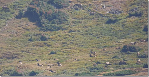
And in the valley, way off to the upper right of the previous picture, you can find a large herd of Elk…of which this picture above captures about half of the herd.

Rocky Mountain National Park, eastern portion Trail Ridge Road

As the Trail Ridge Road continues east, we come to a viewpoint of Hidden Valley.  Yes, that is our road down there, and also along the ridge of the far right mountain.  So far the road we have been on from leaving our campground area has been a 2 lane, well paved road with many pullouts or viewpoints.  Well, that is going to drastically change…

Rocky Mountain National Park, Old Fall River Road

…because the Old Fall River Road is a dirt road, one way (heads east to west and upwards), and wow, was that nice 9 mile stretch of nearly deserted road, compared to the Trail Ridge Road.  Also, since it is down in valley and heads up to Alpine Visitor’s Center, the winds were light.

Rocky Mountain National Park, Old Fall River Road

Marcia and I take turns taking pictures along the 9 mile route.  We might be traveling west, or traveling east, because there are many hairpin turns to help you climb up the mountain side as you eventually make your way to the west.  Above is a picture Marcia took (I can tell due to the mirror of the car) and we were headed to the east (I can tell by the angle to the sun).

Rocky Mountain National Park, Old Fall River Road

Here she got a picture of the rugged mountain tops as we were headed west.

Rocky Mountain National Park, Old Fall River Road

We stopped at this hairpin turn, and one of the few cars we saw passed us.  Our only minor complaint about this dirt road is that on many of the hairpin turns, there was a rut or two that you had to position your vehicle over just right or you would bottom out…I only bottomed out once.  Otherwise, the dirt road was not as bumpy as many dirt roads that I have taken Marcia on…did I mention, she is not a fan of dirt roads…but I got permission for this one…sometimes I just turn onto one. Hot smile   Although it looked like it was going to rain, the rain did not come until after we got back to the motorhome…seems to rain just about every afternoon…but it does not get rid of the smoke which keeps pouring in from the west.
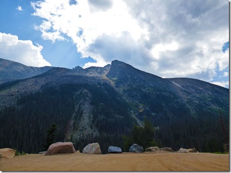
Rocky Mountain National Park, Old Fall River Road

Rocky Mountain National Park, Old Fall River Road

The road has mile markers, and I am also watching our odometer…at an average speed of around 10 mph, and with numerous stops, it takes us about an hour…but it did not seem that long.

Rocky Mountain National Park, Old Fall River Road

We finally see the visitor’s center above (arrow)…we still had around 2 miles to go, but the road is better at the top.

Marmot, Rocky Mountain National Park, Old Fall River Road

I look off into the rocks and see this Marmot moving about…unfortunately, I missed the one opportunity to get its front side…

Rocky Mountain National Park, Old Fall River Road

One last look at the valley that lies below the visitor’s center, off to our left as we drive west.

Elk, Rocky Mountain National Park, Old Fall River Road

And one last look at the herd of Elk in the upper far side of the valley….

Leaving Rocky Mountain National Park, mapping vehicle behind us

We did not stop at the Visitor’s Center, just headed straight home, with a stop at a picnic area which had some vegetation that the dogs were allowed to walk on.  (Why do dogs destroy the tundra but Elk, Moose, Deer, Marmots, etc. don’t?)  Anyway, got this picture of what I think is a google maps car…had California license plate, and those are cameras and satellite equipment up on top of the car.  Will have to check back along this highway in a few months and see if we have been captured in Google Maps!

Sunset at Lake Granby 

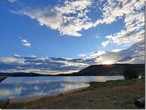
After posting the blog on Wednesday, I captured these sunset pictures after a thunderstorm had passed through…

Sunset at Lake Granby


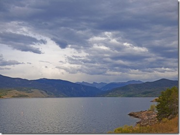
As I do with all sunsets, I turn around to see how it is affecting the landscape opposite the setting sun….

Sunset at Lake Granby

With that, I will say goodbye.  Due to bandwidth, I go down to the public library to post my blogs…don’t even have to get out of the car.  Another 13 nights here in the Rockies!