Pages

Thursday, August 31, 2023

Idalia's Damage to Condo Is ...


Ok, this is NOT, I repeat, NOT our condo, not our street, not even near to us...it was a good 15 miles to our north.  But this is what many people are faced with, in many cases even worse, up and down the west coast of Florida from below Tampa all the way to Tallahassee. 

Our condo did not have any damage at all.  Below is one of the many BING camera videos that were captured looking out our patio towards a neighbor.  I have this camera pointed that way because behind that condo is where we keep our motorhome in storage...I have two cameras on the motorhome and this camera to keep an eye on things.  While gone, I left this camera active just so I can monitor storms.


If you click on the image above, and then in the bottom right of the video open it to full screen, it will show you just how windy and rainy it was Tuesday night.

Got this email from the Condo Board this evening:  

Relax, we are not aware of any damage to any of the units. There was no flooding. We did not even lose electrical power. It was a non-event. 
Everything is back to normal.

The Board


Last year we were in Florida when Hurricane Ian came for a visit.  It had a direct line on our community, and so we went over to the other side of Orlando where Marcia's brother lives.  Then we awoke to find out the Hurricane took a turn right into the Fort Meyer's area.  From there it was headed right for the Orlando area.  So left and drove north, got to I-10 and drove west, dropped south to Perry Florida where we stayed safe and sound.  Well, Hurricane Idalia did a real number of Perry this time around.  Above is just an example of what it did to a gas station.  Here is a link to see a video of this falling over: Click Here for Video

I was awake for much of Tuesday night / Wednesday morning, but before hitting the sack tonight I just wanted to let everyone know that our home is safe and sound.  My heart goes out to those who lost everything.  The amazing thing is just how quick some of the flooding has gone down.  The Sponge Docks in Tarpon flooded, and they were quickly cleaning up the water so that they can open again on Thursday, Friday at the latest.  Crystal Beach, where I have taken some nice sunset shots over the year, had water all the way up on the roadway Wednesday morning, but by Wednesday evening the water had receded and people were taking sunset pictures.  Three deaths were attributed to the weather, two were separate automobile accidents.  So now Floridians clean up, and get ready for the next hit.  Thank goodness, there is nothing threatening Florida or any other area of the U.S. on the horizon.

We have 7 more days here in Cromberg before we head back to the Sacramento area.

Monday, August 28, 2023

Predicting Hurricane Paths


One thing about Florida is...you have to watch for Hurricanes from June through November.  96 percent of the major hurricane days occur from August to October, (according to NOAA, the National Oceanic and Atmospheric Administration)  The ONE good thing about hurricanes is that unlike tornadoes, where your provided perhaps a half hour, but sometimes only minutes of a warning, a hurricane gives you days of warning, if you heed the warning.

Paul Dellegatto has been with WTVT, Fox 13, in Tampa for 33 years, and has more experience with Hurricanes for the Tampa area than just about anyone else.  From June through November I monitor his Twitter page consistently.  Above is his first tweet of what is now known as Idalia.   

But the site I follow even more closely is NOAA's National Hurricane Center.  Above is what they posted on Thursday, August 24th, four days ago.  I first saw this, then went to Paul's Twitter page, and then had my first big GULP with a slight lump in the back of my throat.  By the way, I had been following Hurricane Franklin from when it was a Orange X...it is headed north and then north east, away from land.  I first saw Idalia (pronounced  ee-DAHL-yuh) when it was a Yellow X, and then it went from Yellow to Red and really got my attention.

On Saturday it became a Tropical Depression, and then quickly a Tropical Storm by Sunday morning.  Once they are a Depression, you can start to get a path, as shown above. At the tip of the red arrow is where our Condo sits, just over three miles from the Gulf.  Our condo sits at just at 13' in elevation...we are not considered in the flood zone, although a few of the condos closer to the entrance are in the flood zone.

So this is where we are as of 1 pm Pacific Time (our current time zone).  The forecast calls for it to hit land Tuesday night/Wednesday evening. Current impact with land is 100 miles to our northwest, as the crow flies.  

This is a close up view of where it 'might' hit landfall.  I say 'might' because this far out, it is too hard to predict it.  Since it turned into a depression, this 'line' has ranged from being over Perry, which is the top red circle, and as low as Chiefland, which is the bottom red circle.  The distance along the shore is about 33 miles in length.  

So, why did I use the word "MIGHT" in the above paragraph?  This picture above is of Hurricane Ian, last year.  The paths shown were the ones they thought it would follow as of September 25th.  Three days later it slammed into the coast far below each prediction.  So much so that many of the people down south of Punta Gorda where it hit said they were unprepared because 2-3 days earlier it was going to hit well above Tampa.  Then about 24 hours before it hit a forecast had it hitting Tampa...then a few hours later it was moved down closer to where it did hit land.  Those people fell asleep because they were looking at the dark line...ignoring the 'cone' of where it could hit.  

Above you can see the 'cone' in light grey...and it clearly shows that Punta Gorda was in play as where it 'could' hit.  But people saw the 'red line', which is where most models showed where it probably could hit.  

This is the 4 pm release, not much of a change.  Except that the center of the Tropical Storm has not moved very far since it became a Tropical Depression...only about 80 miles.  Monday was suppose to be the day of more rapid movement...it has not happened yet.

So Paul says that this 'could' be good news...perhaps the storm won't be as strong as first predicted.  We can only hope so.  And being on the edge of the cone still leaves that lump in the back of my throat...and since we don't have any cats, and Indy does not shed very much, it surely can't be a furball stuck back there...

NOTE:  We are in California, far away from the danger posed by this up and coming Hurricane


Monday, August 14, 2023

Sunset Through The Trees


Indy needs out one last time each evening, and this typically leads me to a view of the sun setting through the trees to the west.

As with any sunset, you also need to look to the east to see what the last of the sun's rays do there.  This one tree always illuminates with the sun's last rays.

And then there are the needles and branches that are between the camera lens and the setting sun.

In all my stops, I have never seen sunsets through this type of view.  It is not as pretty, but it is interesting...and peaceful.


Yesterday I decided to head on back to the river and see this sunset coming on.  With clouds to the west, which typically produce a real good sunset.  These pictures above are on the way to the river, taken at the exact same spot.  The lower one focus in on the house that is in the distance.  I thought what a nice place to live...sunrise over the vast meadow to the east, and sunsets to the west which are easily accessible by either going out into the meadow, or going down by the river.


As I near the river I see a deer...a rare event in this area that was full of dear just 12 months ago.  They had 180" of snow last winter.  The grass that grew at the base of trees was buried deeply under the snow.  As the winter progressed, the deer got thinner and thinner...and the deer herds got thinner and thinner.  Mark, owner of the park here, said that the deer that you do happen upon this year are about the sized of a Great Dane.  Earlier in the day I went to Quincy to get some food at Safeway and saw my first deer while here...and it was the size of a Great Dane.  This one above that I saw yesterday evening was barely larger than a Great Dane.  I did see a much larger deer running across the meadow later that I just could not get a picture of...and it looked much larger and older...so some did survive...perhaps some farmer who put out some hay.  (However, feeding big game animals is prohibited in California (Code of Regulations, Title 14, Section 251.3).


I got to the river just in time for the last of the sun's rays.  It is a bit prettier with the clouds, which glow with yellows and red alongside the dark clouds.   One thing I learned from last time, if I hurry back the park I can capture the same sunset again due to the increased 200 ft of elevation.


Sunsets through the trees are nice...unobstructed sunsets...especially those with clouds...just can't be beat.


Friday, August 4, 2023

Sunsets, Landscapes & Things - Cromberg, Ca


A couple of days ago I was taking Indy out for her final potty break and I am "Blinded by the Light,  Revved up like a Deuce..."  (Deuce like a Little Deuce Coupe, a 2-seater Hot Rod...you have either heard the song and get it, or you don't...)   A SUNSET!  Never thought about getting a sunset among all these trees...but there it is right out the door!

I know there is a large meadow on the other side of the park, so I hurry over there..

Just as the sun says goodnight...

Fast forward to today and I am ready to capture the sunset outside of the park.  Above is another picture of the sun as it is 30+ minutes from setting.

I had scouted out a place and found a bridge about 2 miles away that crosses the Feather River.  So I head over there, and get this picture to the west a few minutes before it sets over the mountain...it is blocked by the trees to make the picture.

To the east is this view above.  Below are some more pictures as the sun goes over the mountain...


The last picture is to the east.  There is no sign of the typical yellow-orange coloring, which may or may not have happened as I wanted to get a few more pictures of the area, some of which are shown below...some were taken when I first went out to explore the river bridge a few days ago.

A couple of the surrounding mountains, pictures taken a few days ago.


The Feather River Rail Route, looking west above, and looking east below.  It is currently owned by the Union Pacific Railroad and is used primarily by freight trains, although the California Zephyr use run this route on its way to Chicago.

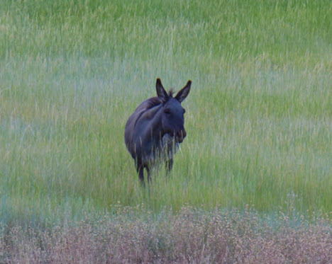
Sloat Towne Hall, built in 1935, is the only public building remaining the town of Sloat which at one time had a population of 2,000.   Below looks like a Mule, something one does not see very often.


Not all of California is owned by the Democratic Party.   Above is one of the more flashy Trump support signs.

On my way back to the Park I got a few pictures with the last of the sunlight lighting up the hills.  Normally the meadow would have deer in it, but this year the deer are scarce.  The extreme snowfall either moved them to lower elevations, or they did not survive.  Mark, the owner of the RV Park, said they had about 180" of snow this year...he said a typical year is around 60-80".